Amazing Islands: Heard and McDonald. Warnings for the curious
The first discovery of the islands is attributed to the British captain Peter Kemp and dates back to 1833, although the honor of their discovery was also disputed by the American captain Heard, who was the first to collect reliable information regarding the geography of the islands and their location. McDonald Island was discovered in 1854 by Captain McDonald of the British ship Semarang. The islands were visited almost continuously for 20 years after the first landing on them, but after that they were completely “forgotten” and were only sporadically explored until 1929. From time to time, hunting expeditions were sent here for elephant seal meat, seal fur and penguin eggs (especially king penguins). penguin), but then their fishing was banned.
In 1983, Heard and McDonald Islands were listed as an Australian National Treasure. This placed an obligation on the Australian government to ensure that the natural values of the area were preserved, and the waters have since been designated as protected waters. And in 1997 the islands were included in the List World Heritage UN and UNESCO as the most striking and best-preserved example of an isolated ecosystem of the southern Indian Ocean. The whale grasslands around Heard Island are still considered to be the most abundant in the region.
Heard and McDonald Islands are a classic example of sub-Antarctic nature with low diversity of some species, but huge populations of others - in this case, birds and marine mammals. The landscape of the islands - a mixture of volcanic and glacial forms - is also unique and is not found almost anywhere else on Earth. Conditions for natural evolution are excellent due to its isolation and far fewer anthropogenic factors affecting the local ecosystem than anywhere else on the planet (only Antarctica can be compared to the islands in this respect to some extent). As a result, an increasing number of tourist cruises to Antarctica, so popular in last years, passes through these harsh places. And the unusual geology and ecology of the islands attracts scientists from all over the world.
Heard Island
The main and largest island of the group consists of the vast Big Ben volcanic massif, which has an almost perfectly circular shape and is 25 km in diameter (at sea level). Almost entirely covered by a glacier, the complex cone of Big Ben is, in fact, a huge underwater mountain of the Kerguelen Plateau and consists mainly of basaltic lavas. The volcanically active Mawson Peak - the highest point of the island (2745 m, currently the volcano is dormant) - is a caldera 5-6 km in diameter, which has pierced the north-western slope of Big Ben. Small companion cones frame the entire island, most of them on the northern coast. The somewhat smaller (706 m high) young volcano Mount Dixon is located on the northwestern tip of the island, forming with its slopes the teardrop-shaped rocky Lawrence Peninsula, connected to the island by a narrow strip of isthmus. It is the result of the most recent historical manifestation of volcanic activity, which created a peninsula 9 km long and 5 km wide with more than two dozen separate young basaltic flows on the flanks. Each of them is of great interest to scientists, since all the young lava tongues of the western part of the island have their own unique chemical composition. And externally, when the ice melts, they look very picturesque - multi-colored stripes of different chemical composition lava flows create a very characteristic picture. In Western and northern slopes Lawrence Peninsula, especially near Red Island, there is a unique geological phenomenon - a kind of sandwich of rocks, in which the so-called “acidic” lavas lie below basaltic lavas, which is very rare and, due to the different nature of the lavas, creates that unique surface pattern , for which this place is famous.
To the northeast, at the base of the Azorella Peninsula, lies the protected Atlas Bay - the only place on the island where it is possible to land more or less without problems. It is here that all the bases of scientific research expeditions are usually located and meteorological observations are carried out. Here is also the only (and oldest - 50 years old) structure on the island - the Anare Station research station, used from 1947 to 1954 in the Australian National Antarctic Research Expedition (ANARE) program. Currently, the base has “moved” to Antarctica, but the building has been preserved and still exists, representing both the only monument to human activity on the island and a popular point for bird watching. The rest of the coast is inaccessible, so until now only specialized and well-equipped scientific expeditions have visited it.
Heard Island is an important nesting site for seabirds and marine mammal rookeries. In these turbulent and harsh places, sea pigeons, frigate birds, albatrosses, penguins and other native inhabitants of the Subantarctic are found in abundance. In terms of the density of bird and sea animal populations, these waters are considered one of the best in the world, so it is the animals, along with the fantastic landscapes, that are the main decoration of the islands. Particularly large colonies of animals can be seen in summer time on ice-free areas of Heard Island - on the Elephant Spit Peninsula, on the shores of Winston Lagoon, Manning Lagoon (here the shining whiteness of the Gotley Glacier glacial tongue serves as a backdrop for thousands of bird colonies), on the rocks of Exile Rock and Franklin Rock off the southern coast, as well as almost the entire coast of the Lawrence Peninsula.
McDonald Island
Small McDonald Island (2.5 sq. km) remains a virtually unexplored area of the earth's surface today. The number of people who have visited its harsh shores does not exceed 50 people, so very little is known about it. This rocky piece of land, shaped like an hourglass, is also volcanic in origin. Moreover, unlike its big neighbor local volcano has already shown its activity several times and continues to grow. The steep cliffs of the northern plateau slope gently down to a narrow central isthmus, beyond which the equally rugged mountainous region of Maxwell Hill begins. MacDonald Rocks are practically lifeless, but the coastline and surrounding waters are literally teeming with life. To the north of it lies a series of tiny rock islands (Meyer Rock, Flat Island and others), which are occupied by eternally noisy bird colonies. And in the waters around the island there is as much marine life as in the entire North Atlantic, so it is deservedly included in protected area, into which the entire archipelago has been transformed.
Heard Island and McDonald Islands, abbreviated HIMI) is a small uninhabited archipelago in the southern Indian Ocean. It consists of two main islands - Heard and McDonald, as well as many small outlying islets, rocks and reefs. All of them are external territories of Australia.
Geography
Landscape of Heard Island overlooking Mawson Peak  Archipelago map
The islands are some of the most remote landmass on Earth: they are approximately 4099 km southwest of Perth ( Western Australia), 3845 km southwest of Cape Louwin (the extreme southwestern point of Australia), 4200 km southeast of South Africa, 3830 km southeast of Madagascar, 1630 km north of Antarctica and 450 km southeast of Kerguelen.
Heard Island (53°06 S 73°31 E / 53.100° S 73.517° E / -53.100; 73.517 (G) (O)) is the summit of an underwater volcano of the Kerguelen Plateau and It is 43 kilometers long and 21 kilometers wide. Mawson Peak is the highest point of the island, the height above sea level is 2745 meters. This is one of two active volcanoes and at the same time the highest point in the territory belonging to Australia. About 80% of Heard's surface is covered with snow and ice, which form the character of the island's coastline. The area of the island is 368 km.
McDonald Island (53°03 S 72°37 E / 53.050° S 72.617° E / -53.050; 72.617 (G) (O)) - small and rocky, located 44 kilometers to the west, also volcanic in origin. Its highest point is 230 meters above sea level. The island is bordered by steep cliffs and previously consisted of two parts - the northern plateau and the southern steep Maxwell Hill, connected by a narrow isthmus. The area of the island is 2.5 km.
Of the remaining islands of the archipelago, the largest is Shag Island, as well as Morgan Island, Sail and Black rocks are located 10 kilometers north of Heard, and Flat Island (now part of MacDonald) and Meyer Rock are slightly north of MacDonald . total area all these small islands and rocks - 1.1 km. The territory also includes all territorial waters within 12 nautical miles from the coastline. Together with these islets, the total area of the archipelago is 372 km.
The McDonald Island volcano, after being dormant for 75,000 years, has become active since 1992 and has had several eruptions since then. Satellite images taken in 2004 showed that volcanic activity had merged McDonald Island with Flat Island into one island, roughly doubling its area. As a result of volcanic activity between November 2000 and the end of 2001, the area of McDonald Island increased from 1.13 to 2.45 km, and the highest peak is now about 230 meters high instead of 186 meters in 1980. However, volcanic activity destroyed almost all the vegetation on the island. The last eruption supposedly occurred on August 10, 2005. Restoration of vegetation cover is currently ongoing.
Judging by NASA satellite data, at the end of October 2012, the eruption of the Mawson Peak volcano began on Heard Island and continues to this day.
There are no ports or harbors on Heard and Macdonald, sea vessels you have to drop anchor off the shore. The coastline is 101.9 km long, there are 12 miles (22 km) of territorial waters, and a 200 mile (370 km) zone declared by Australia as an exclusive fishing zone.
The antipode for the central Mawson Peak is located less than 70 kilometers southwest of Prince Albert (Saskatchewan, Canada).
Climate
The climate is subantarctic - mild winters (+0.1 °C) and cold summers (+4.2 °C). Most days of the year are windy and cloudy. Winds are predominantly westerly and consistently strong. Monthly average wind speeds range from about 26 to 33.5 km/h, with gusts in excess of 180 km/h recorded. Annual precipitation at sea level on Heard Island is typically between 1300 and 1900 mm. Precipitation occurs every three out of four days, usually in the form of drizzle or snow.
Flora
Conditions
The islands are in the insular tundra ecological region of the southern Indian Ocean, which includes several sub-Antarctic islands. In this cold climate, plants are mainly grasses, mosses and lichens. Low plant diversity is due to island isolation, small land size, harsh climate, short, cold growing season and, in Hurd's case, significant ice cover. The main environmental determinants of vegetation on subantarctic islands are: exposure to wind and salt spray, water availability, soil composition, nutrient availability, trampling by birds and seals, and, in some cases, altitude. In Hurd's conditions, salt spray impacts and the presence of breeding and moulting birds and seals have particularly strong effects on the composition and structure of vegetation in coastal areas.
Mosses, liverworts and lichens
Bryophytes and lichens make a significant contribution to the overall biodiversity of the Heard, with 43 species of mosses, 19 liverworts and 71 lichens recorded, often occupying habitats unsuitable for vascular plants, such as rocks. Bryophytes are present in most large plant communities. Lichens are common on outcrops and are the dominant vegetation in some areas. MacDonald's 1980 study recorded a significantly lower diversity of such plants, namely four species of mosses, eight lichens and some algae and fungi.
Seaweed
At least 100 species of terrestrial algae are known on Heard, typically growing in permanently moist and ephemeral habitats. Sea forests of the giant Antarctic kelp Durvillaea antarctica are found in various locations on the island and at least 17 other seagrass species will be added once the latest specimens collected are identified. The low algae diversity is due to the island's isolation from other areas, uninhabitable beaches, constant friction from waves, tides and small rocks, and the extension of glaciers into the sea in many areas.
Fauna
 King Penguin on Heard Island
The islands, now little touched by human activity, are home to huge populations of penguins, pinnipeds and seabirds.
Mammals
Pinnipeds on the Heard were virtually extirpated in the late 19th century, after which seal numbers became too low for economic use. Since then, their population has increased and been protected. Among the pinnipeds that breed on the Heard are southern elephant seals, Kerguelen and subtropical fur seals. Leopard seals regularly visit the rookeries in winter, but they do not breed on the archipelago. Crabeaters, Ross and Weddell seals are only occasional visitors.
Birds
Heard and Macdonald are predator-free and provide favorable habitat and breeding habitat in the middle of the vast Southern Ocean for a variety of birds. The surrounding waters provide food for the birds. The islands have been identified international organization by BirdLife International as an important area for birds as it contains a very large number of seabird nesting sites.
19 species of birds have been recorded as breeding on Heard and McDonald Islands, although volcanic activity on McDonald over the past decade has likely reduced vegetation cover and reduced the number of bird nesting sites.
Story
 Processing harvested elephant seals on Heard Island - 19th century
Heard Island was discovered by American captain and sealer John Heard on November 25, 1853, while his ship Oriental was sailing from Boston to Melbourne. Shortly after Heard's discovery, on January 4, 1854, the captain of the ship Samarang, William MacDonald, discovered the island named after him. After this, for more than 20 years, the islands were regularly visited by hunting expeditions, and a small settlement of hunters arose (up to 200 people). However, by 1880 most of The seal population was destroyed and the hunters left the island. After this, until Douglas Mawson's expedition in 1929, virtually no one showed economic or scientific interest in the archipelago. People have landed on MacDonald only twice in history - in 1971 and 1980. No official landings have been recorded on the neighboring island of Flat Island.
The archipelago has belonged to Great Britain since 1910, when the flag of this country was raised on Heard. On December 26, 1947, the islands were transferred to Australian administration and became part of the Australian Antarctic Territory, but after Australia signed the Antarctic Convention in 1961, they formed a separate external territory. There is no permanent population, but the islands are visited by tourists (without landing) and scientific expeditions (to Heard Island).
Heard and McDonald Islands were designated an Australian National Treasure in 1983 and a UNESCO World Heritage Site in 1997.
Although the islands are uninhabited, they have been assigned their own .hm domain.
Governance and Economics
The Islands are a territory (Heard Island and McDonald Islands Territory) administered by Australia, administered from Hobart by the Australian Antarctic Survey of the Department of Sustainable Development, Environment, water resources, people and communities of Australia. They are home to a large number of seals and birds. The islands contain a marine reserve with a total area of 65,000 km, visited mainly by researchers. There is no permanent population.
From 1947 to 1955, scientists visited a camp on Heard near Atlas Cove in the northwestern part of the island, which was again occupied by American scientists in 1969 and expanded in 1971 by French explorers. Scientists landed on MacDonald in 1971 in the area of Williams Bay. Later expeditions used a temporary base near Spit Bay in north-east Heard on several occasions, for example in 1988, 1992-93 and 2004-05.
Without population there is no economic activity. The only one natural resource the islands are fish; The Australian government allows limited fishing in surrounding waters. Time zone of the islands: UTC +5.
This part of the Commonwealth of Australia is located several thousand kilometers from its continental territory. Besides, no one lives here. None natural resources not found here. And any hunting or even just staying without permission is prohibited. From time to time, the islands are shaken by volcanic eruptions, changing the contours of their coasts. The only inhabitants of the islands are elephant seals and waterfowl, which feel completely safe.
SUB-ANTARCTIC ARCHIPELAGO OF AUSTRALIA
Hurd and MacDonald - uninhabited islands in the southern Indian Ocean. They belong to the Commonwealth of Australia, located at a distance of over 4 thousand km from it, and are managed by the country’s Department of Natural Resources and Energy.
Heard is rugged and mountainous, covered 80% by compacted snow and small glaciers forming coastline islands. It represents the surface part of the former underwater volcano of the Kerguelen underwater plateau.
Dominates the island mountain range Big Ben with its highest peak, the volcanic Mawson Peak. The volcano is covered with glaciers that descend to the sea in sheer cliffs 15-30 m high. Mawson - highest peak Commonwealth of Australia. This nearly three-kilometre peak is higher than 2228m Mount Kosciuszko, the highest point in mainland Australia.
Mawson is one of only two active volcanoes located in the Commonwealth of Australia and the entire Antarctic region.
The second volcano is located on the small and rocky McDonald Island, which is located 43.5 km west of Heard. In 1992, it broke its long silence and began to erupt, as a result of which its area doubled (from 1 to 2.5 km2), its height increased and vegetation was completely destroyed.
Since then, eruptions on MacDonald have occurred from time to time, most recently in 2005. The highest point of the island is a small plateau with a glacier total height 230 m above sea level The plateau is surrounded by steep cliffs sloping down to the coast and consists of a northern plateau and a steep southern hill, Maxwell Hill.
The islands are located in the subantarctic climate zone, where it is windy and cloudy all year round; in the autumn-winter period there can be light rain or snow for a long time.
The other landmass of the archipelago consists of many small outlying islets, rocks and reefs, the largest of which are the Shag Islands, 10 km north of Heard, as well as Flat Island and Meyer Rock, located south of MacDonald.
In 1987, the islands were included in the UNESCO World Heritage List.
This Australian archipelago includes territorial waters within 12 miles of the coastline of each island.
ADVISING FROM A FAR
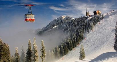
Abundance of animals pristine nature and the unique landscape of the islands attract many tourists. There are no mooring facilities on the shore; liners drop anchor off the coast, and tourists view the islands from board: landing on the shore is strictly prohibited.
The islands were named in honor of their discoverers. American captain John Heard discovered the archipelago on November 25, 1853, while his ship Oriental was sailing from Boston to Melbourne, and the main island was named after him.
The second largest island was discovered on January 4, 1854 by the captain of the British ship Semarang, William MacDonald, and received his name.
Until the 1880s The islands were visited quite often, but interest in them disappeared, since it turned out to be too expensive to export the hunted animals from here, and almost the entire population of seals was exterminated.
From 1910 the islands were considered a British colonial possession until they were transferred to Australia in 1947.
Despite the severity of the climate, Heard, Macdonald and the small islands surrounding them are nesting sites for seabirds and rookeries for marine animals typical of the sub-Antarctic belt. Sea pigeons, frigate birds and albatrosses nest on the cliffs and coastline, as well as king and emperor penguins and the world's largest colony of golden-haired penguins. There are hundreds and hundreds of thousands of birds here, especially on the Exile and Franklin rocks on south coast Heard Islands. Massive concentrations of animals - elephant seals, as well as birds appear in the summer in the Heard territories freed from snow and ice - the Elephant Spit Peninsula, on the shores of the Winston and Manning lagoons, and the Gotley Glacier.
Due to the remoteness of the islands, the nature of these places is almost untouched by humans. There is not a single introduced (alien, imported) species of living organism here. Coastal commercial fishing is permitted to a limited extent.
The only structure on Heard Island is the abandoned Anare Station research station, used from 1947-1954. Australian National Antarctic Research Expedition.
Atlas. The whole world in your hands No. 401
The climate is subantarctic - mild winters (+0.1 °C) and cold summers (+4.2 °C). Most days of the year are windy and cloudy. Precipitation often occurs in the form of drizzle or snow.
The islands, little affected by human activity, are home to huge populations of penguins, seals and seabirds.
The archipelago has belonged to Australia since 1947 as part of the Australian Antarctic Territory, but after Australia signed the Antarctic Convention, the islands began to form a separate external territory. There is no permanent population, but the islands are visited by tourists (without landing) and scientific expeditions (to Heard Island).
Heard Island and McDonald Island, located 44 kilometers to the west, are included in the UNESCO World Heritage List.
Although the islands are not inhabited, they are given their own domain.hm.
Heard Island was discovered by American captain and sealer John Heard on November 25, 1853, while his ship Oriental was sailing from Boston to Melbourne.
Heard Island (53°06′S 73°31′E (G) (O)) is the summit of an underwater volcano on the Kerguelen Plateau and is 43 kilometers long and 21 kilometers wide. Mawson Peak is the highest point of the island, the height above sea level is 2745 meters. This is the only one active volcano and at the same time the highest point in the territory belonging to Australia. About 80% of Heard's surface is covered with snow and ice, which form the character of the island's coastline.
The area of the island is 368 km².
MacDonald
Shortly after Heard's discovery, on January 4, 1854, the captain of the ship Samarang, William McDonagh, discovered the island named after him.
McDonald Island (53°03′S 72°37′E (G) (O)) is small and rocky, also volcanic in origin, the highest point is 230 meters above sea level. The island is bordered by steep cliffs and consists of two parts - the northern plateau and the southern steep Maxwell Hill, connected by a narrow isthmus.
The area of the island is 2.5 km².
People have landed on the island only twice in history - in 1971 and 1980.
Other islands
The largest of them, Shag Island, is located 10 kilometers north of Heard Island, and Flat Island and Meyer Rock are slightly south of MacDonald. The territory also includes all territorial waters within 12 nautical miles from the coastline.
The total area of the archipelago is 412 km².
No official landings have been recorded on Flat Island.


Map of the location of Heard and McDonald Islands.
Heard Island and the McDonald Islands group are part of a subantarctic uninhabited archipelago located in the southern Indian Ocean, southwest of the Australian continent.
This archipelago consists of two main islands - Heard and McDonald (located 44 kilometers west of Heard), as well as many small outlying islets, rocks and reefs, the largest of which are Shag Island, (located about 10 kilometers north of the island Heard), Flat Island and Meyer Rock (located just south of MacDonald).
The total area of all the islands and rocks of the archipelago is about 372 square kilometers.
Geographically, the archipelago is part of the external territories of Australia and is its possession. These territories include territorial waters at a distance of 12 miles from the coastline of each of the islands of the archipelago.
Scheme for the removal of Heard and MacDonald Islands from the Australian continent.
Story.
The palm of the discovery of Heard Island is given to the British captain Peter Kemp and dates back to approximately 1833, although this fact is controversial, the laurels of the discoverer have long been disputed by the American captain John Heard, who is believed to have been the first to collect fairly complete and meaningful information regarding geographical location archipelago. Heard is said to have discovered the archipelago on November 25, 1853, while his ship Oriental was sailing from Boston to Melbourne. The main largest island of the archipelago is named after the American captain. McDonald Island was discovered on January 4, 1854 by the captain of the British ship Semarang, William McDonald. The island and the group of islands around it were named after him.
The islands of the archipelago were frequently visited for 20 years after their discovery, but after that interest in them disappeared and they were explored only from time to time. It happened that hunting expeditions were sent to them to hunt for elephant seals and seals, and king penguin eggs were also obtained. This continued until these types of fishing were banned.
The archipelago was officially transferred to Australia by Great Britain in 1947.

Heard Island. View of East Coast and Mawson Peak Volcano.
Origin and geography of the island.
Heard Island has the following geographical coordinates: 53°06′ S w. 73°31′ E It is the above-water part of the once underwater volcano of the Kerguelen Plateau and is 43 kilometers long and 21 kilometers wide. The total area of the island is 368 square kilometers. Highest point islands - Mount Mawson Peak, its height above sea level is 2745 meters. Paradoxically, this is the only active volcano and at the same time the highest point in the territories belonging to Australia. About 80% of the surface of Heard is covered with compacted snow and small glaciers, which finally form the coastline of the island.
McDonald Island has the following geographical coordinates: 53°03′ S. w. 72°37′ E. d. Represents in fact small rock volcanic in origin. The total area of the island is 2.5 square kilometers. The highest point of the island is a small plateau with a glacier with a total height of 230 meters above sea level. The plateau is bounded by steep cliffs converging towards the coast, and consists of two parts - the northern plateau and the southern steep Maxwell Hill, connected to each other by a narrow passage.
View of Mawson Peak Volcano from the weather station Anare Station.
Climate.
The climate on the archipelago is typically subantarctic - not very severe winters (on average +0.1 °C) and rather cold summers (on average +4.2 °C). The weather is windy and cloudy almost throughout the year. Especially in the autumn-winter period, precipitation in the form of light rain or light snow is quite frequent.
Emperor penguin on Heard Island.
Flora and fauna.
Heard Island, McDonald Islands and the adjacent islands and rocks with the coastal waters surrounding them, despite the severity of the climate, are literally saturated with life typical of this geographical zone. In general, the archipelago is a nesting place for seabirds and rookeries for marine animals. Sea pigeons, frigate birds, albatrosses, king penguins and other inhabitants typical of the subantarctic zone nest on the slopes and coasts of the islands. By a large number birds and marine mammals, these islands, along with similar ones, are perhaps the first in the world, and therefore the abundance of animals, the untouched pristine nature of the subantarctic, the unique landscape of the islands of the archipelago are the most attractive for travelers and lovers extreme recreation. Huge numbers of marine animals and birds can be seen, especially in the summer, in the Heard territories freed from snow and ice - on the Elephant Spit Peninsula, on the shores of Winston Lagoons, Manning Lagoons, Gotley Glacier, on the coastal cliffs of Exile Rock and Franklin Rock on the south coast of the island.

Emperor penguins on the northern coast of Heard Island.
T urism.
Unfortunately, the islands are not inhabited. The only human creation on Heard Island is a single structure, the disused research station Anare Station, used from 1947 to 1954 by the Australian National Antarctic Research Expedition (ANARE) program. Now the base itself is located in Antarctica, and its building has been preserved and still exists, representing both the only monument to human activity on the island and a popular point for bird watching.
Before the beginning of this century, people landed on McDonald Island only twice in history - in 1971 and 1980 for the purpose of geographical and geological research. In general terms, the number of people who visited the island does not exceed 50 people.
IN this moment The islands are of interest only to tourists - lovers of extreme recreation and exotic travel. Regularly many travel agencies Australia and New Zealand organize tourist expeditions to the islands, but without landing on the shore.
View of the east coast of McDonald Island.