Where are the Caribbean Islands? Underwater and terrestrial world of the Caribbean Sea Average and maximum depth of the Caribbean Sea.
The Caribbean (Central American) Sea is a marginal sea of the tropical zone of the Atlantic Ocean. In the north, its borders run from the Yucatan Peninsula through the islands of Cuba, Haiti, Puerto Rico to the Virgin Islands, in the east - along the arc of the Lesser Antilles. The southern border of the sea is the coast of South America (Venezuela, Colombia) and Panama. The western border runs along the shores of Central America (Costa Rica, Nicaragua, Honduras, Guatemala, Belize and Mexico).
The area of the sea is about 2,777 thousand km2, the volume of water is 6,745 thousand km3, the average depth is 2429 m, the greatest depth is 7090 m.
Through numerous straits in the archipelagos of the Greater and Lesser Antilles, the Caribbean Sea is connected to the Atlantic Ocean, and through the Yucatan Strait to the Gulf of Mexico. Thus, the sea is a flowing basin through which the waters of the upper layer move from east to west. Therefore, the Caribbean Sea is sometimes called the “sea of flowing waters.”
Most of the straits connecting the Caribbean Sea with the Atlantic Ocean are shallow, and only a few have a threshold depth of more than 1000 m. These are the straits of the Greater Antilles: Windward - 1650 m deep, Anegada - 1740 m and the Lesser Antilles: Dominica - about 1400 m, as well as St. Lucie and St. Vincent - up to 1000 m. The main water exchange with the Atlantic Ocean occurs through these straits. From the Caribbean Sea, water flows into the Gulf of Mexico through the Yucatan Strait, which is about 2000 m deep.
The nature of the seashores varies. The coast of Central America is mostly low-lying and wooded, while the coast of South America is mostly high and steep, with some low-lying areas covered with mangroves. Most of the islands of the West Indian archipelago are high and mountainous.
The western coast of the Caribbean Sea and the part of the coast east of the Gulf of Maracaibo are fringed by islands and reefs. In the western and southern parts of the sea there are the main bays: Honduras, Los Mosquitos, Darien, Maracaibo, Paria.
The shelf zone in the eastern part of the Yucatan Peninsula is virtually absent and appears only off the coast of Honduras, reaching its maximum width at Cape Patuca (240 km). Then it narrows again and does not exceed several kilometers off the coast of Costa Rica, Nicaragua and Panama. This entire shelf area is replete with banks. Further along the coast of South America, the shelf expands again, reaching 100 km off the coast of Venezuela.
There is almost no shelf off the coast of the West Indies archipelago; the slopes of the islands slope steeply to the sea. A particularly steep slope along the southern coast of Cuba, its inclination angle is 17°, and in some places exceeds 45°.
Climate
The climate of the Caribbean Sea is determined by the trade wind circulation of the atmosphere, characterized by high air temperatures, the division of the year into two seasons (dry winter and wet summer), stable winds from the east and northeast, and tropical hurricanes.
The air temperature changes little throughout the year, the annual difference in average monthly temperatures decreases from 4-6° in the north to 1-2° in the south. The average air temperature in January is 24-27°, in August 27-30°. The maximum temperature can reach 38°, and the minimum does not fall below 12-15°.
The amount of precipitation increases from east to west from 500 to 1000-2000 mm per year with a maximum in the summer months. The highest average monthly precipitation falls in summer off the coast of Panama - up to 400 mm, and the least in winter on the southern coast of Cuba - no more than 20 mm.
The wind regime is determined by trade winds blowing from the east or northeast. In the western part of the sea, trade winds are less stable. The average wind force is 5-7 m/s. Breezes blow along the coasts of the mainland and islands.
The main storm activity in the Caribbean Sea is associated with the West Indies hurricanes. The dimensions of these tropical cyclones are several hundred kilometers across and the wind speed is 40-60 m/s. Hurricanes originate in the southwestern Caribbean Sea, east of the Lesser Antilles and off the Cape Verde Islands. From their origins, hurricanes generally move west and northwest to the Gulf of Mexico, where they turn northeast. The speed of a hurricane is 250-550 km per day, its lifetime is on average 6 days. The average long-term frequency of hurricanes in the Caribbean Sea is 3 per year, but in some years there can be up to 20 hurricanes (most often in September).
In accordance with the nature of the winds in the sea, waves and swells in the eastern and north-eastern directions predominate; the most typical (more than 50%) is a wave of 3-4 points. The frequency of disturbances of 5 points or more is 4-5%. The calmest area is considered to be the area between the islands of Cuba, Jamaica and Haiti, where the frequency of calms reaches 10%.
Most of the coast has irregular semidiurnal tides, and irregular diurnal tides in the Lesser Antilles and a small section of the coast of Venezuela. The tide does not exceed 1 m anywhere.
Seasonal level fluctuations are determined mainly by the ratio of the components of the sea's water balance and water exchange with the Atlantic Ocean. As a result of the interaction of these factors, the highest level is observed in early autumn (September - October), and the lowest in January. At most observation points, the magnitude of annual level changes is within the range of 8-30 cm, but in some areas it can reach 80 cm.
Level fluctuations also occur with sudden changes in winds. Short-term rises in level on various parts of the coast were observed during the passage of tropical cyclones.
Bottom relief
The seabed is strongly dissected by underwater ridges into several large basins: Grenada (more than 3000 m deep), Venezuelan (more than 5000 m), Colombian (more than 4000 m), Cayman (more than 6000 m) and Yucatan (more than 4500 m). Thus, a significant volume of Caribbean Sea waters is below the depth of the rapids in the straits, as a result of which the deep waters of the sea and ocean differ.
Bottom topography and currents of the Caribbean Sea
Currents
Water circulation in the sea is formed under the influence of the Northern Trade Wind Current, which is about 60° W. is divided into two currents: one of them (the Guiana Current) enters the Caribbean Sea through the straits of the Lesser Antilles, the other (the Antilles Current) moves westward north of the Greater Antilles. Branches that enter the Caribbean Sea through the northern straits of Anegada, Mona and Windward are separated from the Antilles Current. These waters are transported to the sea in a westerly direction.

Grenada Island in the Caribbean Sea
The waters of the Guiana Current enter the Caribbean Sea through the strait between the coast of South America and the island. Grenada and the straits of the Lesser Antilles. Therefore, the Caribbean Current in the eastern part of the sea has two branches: one runs 200-300 km from the coast of Venezuela, the other along the middle of the sea. Approximately 80°W the southern branch turns north and the currents converge. The speed on the surface here reaches 70 cm/s. Next, the main flow of the Caribbean Current follows to the Yucatan Strait and exits through it into the Gulf of Mexico.
At the entrance to the strait, a stream separates from the main flow of water, which turns back and moves along the southern coast of Cuba to the Windward Strait. Anticyclonic gyres form south of Cuba and Jamaica. To the south of the main current, several cyclonic gyres stand out - off the coast of Venezuela, Panama and Costa Rica. In the summer season, cyclonic water movement is also characteristic of the Gulf of Honduras.
In the Windward Strait, most of the section is occupied by Atlantic waters. In the upper layer they enter the sea in the eastern half of the strait, and in the western half, off the coast of Cuba, a reverse flow is observed in a layer up to 100-120 m. In the deep layers, on the contrary, the Atlantic waters are pressed against the island. Cuba, and the flow from the sea goes along the island. Haiti.
In the Mona Strait, there is a fairly strong flow of Atlantic water into the Caribbean Sea in the layer from the surface to 300 m. The reverse movement of water from the sea to the ocean in the deep layers is very weak.
In the Anegada Strait, in the upper layer the current is always directed from ocean to sea, and in the deep layers - from sea to ocean. The core of waters flowing from the sea to the ocean is located at horizons of 800-900 m, their speed is about 40 cm/s. However, as in the Windward Strait, the boundary between multidirectional flows changes its position. Water exchange through the northern straits of Windward and Anegada plays a significant role in the balance of sea waters.
Most of the intermediate Atlantic waters enter the sea through the deep central straits of the Lesser Antilles: Dominica, St. Lucia, St. Vincent, as well as through the strait between the islands. Grenada and the mainland, despite the fact that its depth is no more than 750 m.
The main flow of Caribbean Sea waters goes through the Yucatan Strait into the Gulf of Mexico, and then through the Strait of Florida into the ocean. In the Yucatan Strait, maximum current speeds, reaching 150 cm/s on the surface, are observed along the continental shelf, near the coast. The thickness of the upper current leaving the sea reaches 700-800 m. In the bottom layers of the Yucatan Trench, both the entry of deep water from the Caribbean Sea into the Gulf of Mexico and its reverse transport can occur.
The deep current from the Yucatan Strait partially passes into the Windward Strait, skirting the tip of the Cayman Ridge from the west. Its other part is included in the Columbia Basin, where the deep circulation is anticyclonic.
The water entering the sea in the deep layers of the Anegada Strait also forms an anticyclonic circulation in the Venezuelan and Grenada basins.
The influx of water from the Atlantic Ocean is the main factor in the formation of the hydrological structure of the waters of the Caribbean Sea. The vertical stratification of waters in the sea is associated with the depth of the rapids in the straits of the Greater and Lesser Antilles. The sea waters are well stratified to a depth of 1200 m, weakly in the layer between 1200 and 1800 m, and very homogeneous below 1800 m and to the bottom.
Water temperature and salinity
The horizontal distribution of water temperature and salinity is determined mainly by the circulation system in the sea. Only in the surface layer the distribution of hydrological characteristics is associated with the influence of heating and cooling of the sea, evaporation, precipitation and river flow. The usual zonal distribution of water temperature (its decrease from low to high latitudes) is not observed in the sea.

Water temperature and salinity at the surface of the Caribbean Sea in summer
Thanks to the prevailing system of easterly winds and the general transport of water from east to west, a drift effect and rise of deep waters to the surface are observed near the southern coasts of the sea (especially near Venezuela and Colombia). Therefore, in the eastern part of the sea, the highest water temperature on the surface is observed on the northern shores: 26-26.5° in winter and about 28° in summer. In the central part of the sea the temperature is almost constant - 27-28°, and in the western part it varies from 26° in winter to 29° in summer.
Vertical movements of water in the coastal zone of the sea cause a characteristic slope of isothermal surfaces in a layer up to 600 m. The thickness of the upper layer, uniform in temperature, reaches 100 m along the northern shores of the sea, and only 20-30 m on the southern shores. The temperature jump layer also deepens to the north and rises off the southern shores of the sea. However, with depth, meridional differences in temperature gradually decrease. Thus, at a horizon of 100 m off the coast of Venezuela the temperature is 19-20°, and near Puerto Rico, Haiti and Jamaica - 25-27°. At a horizon of 200 m, the difference in temperature at the southern and northern borders of the sea is 5°, and at a horizon of 600 m - 3-4°.
Below 600 m, horizontal temperature differences become negligible. At a horizon of 800 m, the temperature over the sea area varies from 5.5 to 7°, and at a horizon of 1000 m - from 4.8 to 5.5°. Below 1000 m, the temperature very slowly drops to 4° at a horizon of 1600 m (i.e., near the depth of the rapids in the Windward and Anegada straits). Deep Atlantic water with a temperature of about 4°, entering the sea through these straits, fills its entire deep-water part to the very bottom. From the Caribbean Sea, deep water penetrates into the Gulf of Mexico through a trench in the Yucatan Strait, the depth of which is slightly more than 2000 m. In the basins of the Caribbean Sea, to depths of about 3000 m, the temperature remains 4.1-4.2 °. The presence of albeit small spatial differences in temperature at these depths indicates the ongoing renewal of deep water in the sea.
The salinity value in the surface layer over most of the sea is 35.5-36.5‰. In summer, especially towards the end of the season, the salinity on the surface in some areas is 0.5-1‰ less than in winter. This is explained by the abundance of precipitation and increased river flow in the summer months. The lowest salinity is observed near the islands of Trinidad and Tobago (less than 35‰ in winter, 33-34‰ in summer) and near the southern part of the Lesser Antilles ridge, which is associated with the influence of the Orinoco runoff. A narrow strip of water with the highest salinity for the sea (36.2-36.8‰) is constantly observed along the coast of South America due to the rise of deeper, more saline waters that occur here. Salinity of more than 36‰ is also typical for areas with little precipitation - south of the islands of Haiti and Cuba.
The vertical distribution of salinity is characterized by the presence of a subsurface maximum and an intermediate minimum.
The maximum salinity is associated with subsurface subtropical ocean water entering the sea through the straits of the Lesser Antilles. The depth of the maximum varies from 80 m along the southern shores to 150 m in the middle part and 180-200 m near the northern shores. Its core is located in a layer of temperature jump, salinity in the core decreases from 36.9-37‰ in the eastern part of the sea to 36.5-36.7‰ in the Yucatan Strait.
The salinity minimum is formed due to the spread of intermediate subantarctic water into the sea, which also enters through the straits of the Lesser Antilles in a layer of 700-800 m with a salinity of about 34.7‰. As you move westward, the salinity in the minimum layer increases when mixed with above- and underlying waters and in the Yucatan basin is 34.8-34.85‰.
Below the minimum layer, salinity increases again in the deep North Atlantic water, which enters the sea through the deepest straits of the Greater Antilles ridge. At the horizon of 1700 m, the salinity is slightly less than 35‰ and then does not change until the bottom.
The oxygen content in the upper layer of the sea up to 50 m thick is about 4.5 ml/l. Vertically, it decreases to a minimum (2.7 ml/l) in a layer of 500-600 m. Then, with depth, the amount of oxygen again increases to maximum values (5-6 ml/l), and then very slowly decreases towards the bottom. Significant concentrations of oxygen at great depths are associated with the influx of ocean water. Therefore, interannual changes in the amount of oxygen in the minimum and maximum layers are associated with an increase or decrease in the flow of intermediate subantarctic and deep North Atlantic water into the sea.
Based on the distribution of hydrological characteristics and the peculiarities of the structure of waters in the Caribbean Sea, the following water masses are distinguished:
surface tropical water - occupies a layer of 0-75 m, has a temperature of 26-28° and a salinity of 35-36‰
subsurface subtropical water (75-300 m) - is released at the maximum salinity (36.6-37 ‰) in the temperature jump layer (19-25°);
intermediate subantarctic water (300-1000 m) - characterized by a minimum salinity (34.7-34.85‰) and a temperature of 5-9°;
deep and bottom water (1000 m - bottom) - is formed from deep Atlantic water with a temperature of 4-4.5 ° and a salinity of 34.96-35‰. It occupies the largest volume. According to approximate calculations, the time for complete renewal of this water is about 1000 years.
A significant part of the volume of the Caribbean Sea is occupied by mixed waters.
The Caryaco depression, located on the shelf of Venezuela, with a depth of about 1400 m, has special conditions. The depression is separated from the sea by a threshold with a depth of no more than 150 m, below which it is filled with almost homogeneous water with a temperature of about 17° and a salinity of 36.2‰. Outside the depression, the temperature in the same layers of water is much lower. The descent of such warm water (with a temperature of up to 17°) to depths exceeding 1000 m is a very rarely observed natural phenomenon.
At depths of more than 370 m in the Karyako depression there is no oxygen and hydrogen sulfide appears. True, the maximum content of hydrogen sulfide here is only about 10% of its concentration in the depths of the Black Sea. Anaerobic conditions in the depression are created due to limited water exchange with the sea and the complete consumption of oxygen for the oxidation of organic matter coming from the upper layers of water.
Economic importance
The ichthyofauna of the Caribbean Sea includes more than 800 species of fish, of which about 450 are edible. The number of commercial fish is from 50 to 60 species, but only a few of them produce the bulk of the catches. The overwhelming majority of fish are concentrated on the shelf, especially in coastal areas, in places where deep waters emerge and in areas where rivers flow into the sea.

sand shark
Shelf fish of tropical seas have conditions for both feeding and reproduction in their habitats, so most of them do not make long migrations. The most important commercial shelf fish are snappers (reef perches). In second place are rock perches. Rockfish, crucian carp, and croakers are widespread. In some areas, sardinella, horse mackerel, mackerel, as well as sole, flounder, stingrays, sharks and some other fish species are fished for. Shallow waters with depths of up to 10-20 m, lagoons, small bays, and river mouth areas are particularly diverse in their ichthyofauna. Various types of mullet, tarpan, anchovies, soles, and centropomus are found here.
Ocean fish - tuna, marlin, sailfish, golden mackerel and other inhabitants of the deep-sea Caribbean Sea - make long migrations, but most tuna species breed and spend the first years of their lives in shelf waters and in areas of the continental slope. Accumulations of tuna are confined to zones of rising deep waters, characterized by increased biological productivity.
CARIBBEAN SEA, Caribbean Sea, a semi-enclosed marginal sea in the western part of the tropical Atlantic Ocean. In the west and south it is limited by the mainland coasts of Central and South America, in the north and east - by the ridge of the Greater Antilles (Cuba, Haiti, Puerto Rico) and the Windward Islands from the Lesser Antilles group. It is connected by the Yucatan Strait with the Gulf of Mexico, by numerous straits in the archipelagos of the Greater and Lesser Antilles with the Atlantic Ocean, and by the Panama Canal with the Pacific Ocean. Area 2777 thousand km2, volume 6745 thousand km3. The greatest depth is 7090 m (Cayman Trench).
The coasts of Central America are low-lying and wooded, while those of South America are mostly high and steep, with isolated low areas covered with mangroves. The coasts of most islands are mountainous and steep. The western and partly southwestern coasts of the sea are fringed by reefs. The main large bays are located in the western and southern parts of the sea: Honduras, Mosquitos, Darien, Venezuelan Gulf with Lake Maracaibo, Paria. Of the large islands - Jamaica; many small islands, most of them in the western and southeastern parts of the sea.
The shelf is well defined only off the coast of Honduras, Nicaragua and Venezuela (100-240 km), the continental slope is steep, on average about 17°, in some sections of the slope a steepness of up to 45° is noted. On the bottom, strongly dissected by underwater ridges, deep basins stand out: Yucatan (4800 m), Colombian (4259 m), Venezuelan (5420 m), Grenada (4120 m). In the north of the Caribbean Sea, the deep-sea Cayman Trench stretches from west to east along the southern foot of the underwater ridge of the same name. Most of the underwater ridges (Aves, Beata, Marcelino threshold, etc.) appear to be submerged island arcs. Bottom sediments are mainly represented by calcareous foraminiferal silts. An important factor in sedimentation for the flat relief of basins is turbidity currents; the heaviest precipitation was found in the north of the Venezuelan basin (up to 12 km).
 The climate is marine, warm, with little seasonal variability, determined by the location of the Caribbean Sea in the zone of trade wind circulation of the atmosphere. Average air temperatures in February are 24-27 °C, in August 27-30 °C. The amount of precipitation increases from east to west from 500 to 2000 mm per year. The highest average monthly precipitation falls in summer off the coast of Panama (up to 400 mm), the least in winter off the coast of Cuba (about 20 mm). Northeast trade winds prevail over the sea at speeds of 5-7 m/s. Storm conditions are usually associated with tropical hurricanes, in which wind speeds reach 40-60 m/s. Hurricanes cross the Caribbean Sea in the western and northwestern directions at a speed of 10-20 km/h with an average frequency of 3 times a year (in some years more than 10).
Water exchange with the Atlantic Ocean occurs mainly through deep straits: Windward, Sombrero, Dominica, etc.; with the Gulf of Mexico - through the Yucatan. Seas are predominantly in the eastern and north-eastern directions, on average 3-4, rarely 5 points. The magnitude of annual level fluctuations is small and usually ranges from 8 to 30 cm. Short-term level fluctuations are observed during the passage of tropical hurricanes. The tides are irregular semidiurnal, off the coast of Venezuela - irregular diurnal, up to 1 m.
 Water circulation is set by the branches of the Antilles Current and the Guiana Current, entering the Caribbean Sea through the northern and eastern interisland straits. These waters spread in a westerly direction called the Caribbean Current. In the eastern part of the sea, the current moves in two streams at a distance of 200-300 km from each other. At about 80° west longitude both streams merge into one. The current speed in the western part of the sea reaches 70 cm/s. Off the coast of Cuba and Jamaica, the current forms several anticyclonic gyres; cyclonic eddies are observed along the coasts of Venezuela, Panama and Costa Rica. The waters of the Caribbean Current are carried through the Yucatan Strait into the Gulf of Mexico. In the strait, the highest speeds of surface currents from the side of the mainland coast are up to 150 cm/s.
The surface water temperature varies throughout the year from 26 °C in winter to 29 °C in summer. The deep-sea basins are filled with Atlantic waters with a temperature of about 4.3°C. The average salinity of water on the surface is from 35.5 to 36.5‰. By the end of the summer season, due to the abundance of precipitation and fresh river flow, salinity decreases by 0.5-1.0‰, its lowest values (33-34‰) near the islands of Trinidad and Tobago are explained by the large fresh flow of the Orinoco River. The highest salinity of surface waters is in a narrow strip off the coast of South America and the coasts of Haiti and Cuba (over 36‰).
There are about 800 species of fish in the Caribbean Sea, more than half of which are edible. Of the commercial fish, the most important are representatives of the families of snapper, serranidae, sea crucian carp, several species of mullet, croaker, as well as sardinella, horse mackerel, mackerel, tarpon, and anchovies. Widespread fish of the open ocean are tuna, marlin, sailfish, common lionfish, and sharks.
The Caribbean coast is known for its beautiful beaches and is the largest recreational area with numerous resorts. Busy shipping; passes the sea route through the Panama Canal, connecting the Atlantic and Pacific oceans. Main ports: Santiago de Cuba (Cuba), Santo Domingo (Dominican Republic), Maracaibo (Venezuela), Barranquilla and Cartagena (Colombia), Colon (Panama).
Lit.: Zalogin B.S., Kosarev A.N. Seas. M., 1999. M.G. Deev.
Caribbean sea water temperature. Caribbean Sea coastal water temperature
The data given shows the surface water temperature on the coasts of seas and oceans. To view the values, select the country and then the city that interests you.
10 Fun Facts About the Caribbean
In addition to water temperature, we also provide information on the weather for today, tomorrow and the coming days, surf forecast, sea conditions and waves, sunrise/sunset data and moonrise data.
List of countries and territories in the Caribbean Sea
Water temperature in the Caribbean Sea by month:
Water temperature in the Caribbean Sea in January
Water temperature in the Caribbean Sea in February
Water temperature in the Caribbean Sea in March
Water temperature in the Caribbean Sea in April
Water temperature in the Caribbean Sea in May
Water temperature in the Caribbean Sea in June
Water temperature in the Caribbean Sea in July
Water temperature in the Caribbean Sea in August
Water temperature in the Caribbean Sea in September
Water temperature in the Caribbean Sea in October
Water temperature in the Caribbean Sea in November
Water temperature in the Caribbean Sea in December
To calculate sea temperature, satellite data are used together with observation results from ground stations.
Water temperature, weather forecast and sea conditions are updated daily. Temperatures in shallow areas near the shore may be slightly higher than those shown here.
Caribbean location: Western part of the Atlantic Ocean, between Central and South America.
Area of the Caribbean Sea: 2,754 thousand km2
Average depth of the Caribbean Sea: 2,491 m.
Greatest depth of the Caribbean Sea: 7,680 m (Cayman Trench).
Bottom reliefCaribbean: deep-sea ridges (Cayman, Aves, Beata, Marcelino threshold), basins (Grenadian, Venezuelan, Colombian, Bartlett, Yucatan).
SalinityCaribbean: 35.5-36 ‰.
CurrentsCaribbean Sea moving from east to west, when leaving the Gulf of Mexico they give rise to the Gulf Stream.
Inhabitants of the Caribbean: sharks, flying fish, sea turtles and other types of tropical fauna; There are sperm whales, humpback whales, seals and manatees.
Additional information about the Caribbean: The Caribbean Sea borders the Gulf of Mexico; the shortest sea route passes through it, connecting the ports of the Atlantic and Pacific oceans through the Panama Canal.


Caribbean Sea Wikipedia
Site search:
Caribbean Sea: where it is on the map, photos, area, depth, rivers, fish, countries, cities
Caribbean Sea- a semi-enclosed sea in the Atlantic Ocean, located between Central and South America. Countries washed by the Caribbean Sea: Venezuela, Colombia, Panama, Cuba, Guatemala, Costa Rica, Haiti, Jamaica, Nicaragua, etc.
Area: 2,754,000 sq.
Caribbean Sea - corals, animals, tourism, pirates, interesting facts
km. Average depth: 2500 m. Greatest depth: 7686 m.
The following rivers flow into the Caribbean Sea: Plantaine Garden, Magdalena, Rio Grande, San Juan, Coco, Aguan, Motagua, Rio Hondo, etc.
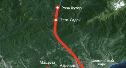
Resort cities located by the sea: Cancun (Mexico), Varadero (Cuba), Montego Bay (Jamaica), Bridgetown (Barbados), Freeport (Bahamas), etc.
Major ports in the Caribbean: Cartagena (Colombia), Santiago de Cuba (Cuba), Maracaibo (Venezuela), Colon (Panama), Limon (Costa Rica), Santo Domingo (Dominican Republic), Kingston (Jamaica).
Large bays: Mexican, Honduras, Venezuelan, Darien, Batabano, Gonave, Guacanaiabo, Paria.
The most important islands of the Caribbean: Antilles, Bahamas, Cayman, Turneffe, Islas de la Bahia. Largest island: Cuba.
Animal life: angelfish, silky shark, hawksbill turtle, barracudas, moray eels, tuna, lobsters, sardines, monk seal, razorback crocodile, etc.
Photos of the Caribbean Sea:


Where is it on the map:
Oceans, lakes and rivers
Caribbean Sea
The Caribbean Sea belongs to the Atlantic Ocean and is located in the tropics of the Western Hemisphere. In the northwest, the reservoir borders the Yucatan Peninsula (Mexico) and connects to the Gulf of Mexico through the Yucatan Pass between Yucatan and Cuba.
To the north and east there are large and small Antilles. In the south, the sea is washed by the northern coast of South America. To the west and southwest is the coast of Central America. Caribbean waters are connected to the Pacific Ocean through the Panama Canal.

geography
The reservoir is considered one of the largest in the world.
Its surface is 2.754 thousand square meters. km. The amount of water is 6,860 thousand cubic meters. km. Maximum depth 7686 meters. It is installed in a so-called trench candle. It is located between Jamaica and the Cayman Islands.
This is an underwater trough between the North American and Caribbean plates. The average depth of the reservoir is 2500 meters.
member
Many countries erase many seas. In South America these are Venezuela and Colombia. In Central America: Panama, Costa Rica, Nicaragua, Guatemala, Honduras and Belize.
The last in this series is the Yucatan Peninsula. The northern part is occupied by 3 Mexican states, and in the south there are territories belonging to Belize and Guatemala.
In the northern part of the Greater Antilles there are countries such as Cuba, Haiti, Dominican Republic, Jamaica and Puerto Rico.
The Antilles region is home to countries such as Antigua and Barbuda, Barbados, Dominica, Grenada, Saint Kitts and Nevis, Saint Lucia, Saint Vincent and the Grenadines, Trinidad and Tobago.

Caribbean on the map
islands
Those who don't know should know that the Bahamas never belonged to the Caribbean. They are located north of Cuba and south of Florida. These are Atlantic waters, and historically this area is called the West Indies.
It covers both the Caribbean and the Bahamas. This term appeared when Columbus discovered America.
In the body of water in question there are the Antilles, divided into large and small. The first includes four large islands: Cuba, Haiti, Jamaica and Puerto Rico. This includes small islands located close to Cuba and form the archipelagos of Los Canareos and Jardines de la Reina.
The smaller Antilles are much more numerous.
They are influenced by the north-east trade wind and are divided into wind, rain or south. The first group has about 50 islands. The southern group extends along the coast of South America and includes both individual islands and archipelagos.
Closer to the western coast of the reservoir there are several archipelagos. These are the Cayman Islands (Grand Cayman, Mali Cayman, Cayman Brac), the Department of Island Bay Islands, which are located in Honduras, as well as the islands of Misquitos and Turneffe.
There are separate islands of San Andres and Providencia.
Rivers
There are many rivers in a large body of water. The largest of them is the South American Magdalene River. It passes through Colombia and is 1,550 km long. The annual flow is the largest at approximately 230 cubic meters.
km. Another Colombian river is called Atrato. Its length is 644 km. Some rivers go to Lake Maracaibo (the largest in South America). The Caribbean Sea is connected to the Gulf of Venezuela by a small slope, the depth of which does not exceed 4 meters.
In Central America we also feed about 30 rivers.
There are rivers on the islands. For example, the Cauto River in Cuba. Its length is 343 km. But the Artibonite River in Haiti is 240 km long. There are rivers in Jamaica. This is the river of milk and the black river.
climate
The climate is tropical. It is created by the Subtropical Caribbean Current, a continuation of the Southern Trade Trend. Hot water flows from southeast to northwest and passes through the Yucatan Channel in the Gulf of Mexico, where the Gulf Stream originates.
Therefore, the annual temperature ranges from 21 to 29 degrees Celsius.
Windmills are dominated by trade winds. Their speed ranges from 16 to 30 km/h. There are tropical hurricanes in the northern part of the reservoir. Their speed can reach 120 km/h. Such strong winds sometimes cause real tragedy: people die, houses are destroyed, cultures die.
For example, Hurricane Mitch, created in the western part of the sea in October 1998, brought a lot of sadness. 11 thousand people were killed, and the same number was not enough. There were 2.7 million people without housing. They were mostly citizens of Nicaragua and Honduras.

economy
The Caribbean Sea is inextricably linked with oil production.
Approximately 170 million tons are produced offshore.
Caribbean Sea: “A true paradise on earth”
tons of oil per year. In addition, the fishing industry is well developed. Sea water annually provides up to 500 thousand tons of fish. However, human activities pollute the environment. Firstly, this negatively affects coral reefs, which are constantly bleached and their ecosystem is destroyed.
This could impact the tourism industry in the best possible way in the near future. Every year about 40 million tourists visit the region. The net profit from them is about 30 billion dollars. Many tourists are attracted by diving and the beauty of coral reefs. About 3 million locals living on the islands are somehow associated with a tourism company. Therefore, environmental problems are quite acute.
Sergey Gubanov
Before you find out where the Caribbean islands are on the world map, you need to get some general information about them. They include the Antilles, which rise significantly above sea level, as well as the Bahamas islands of coral reefs. Most of them are of volcanic origin. Some islands are surrounded by large coral reefs, the peaks of which protrude from the water and are overgrown with palm trees.
The Greater Antilles include four large landmasses that extend from the mainland, including Puerto Rico, Jamaica, Haiti and Cuba. The Lesser Antilles include a scattering of small lands, which include the Bahamas, Caicos, Turks, Burbuda, Antigua, the Virgin Archipelago, Guadeloupe, Barbados and so on.

Hard to say, what country is the caribbean islands, since these include all land areas washed by the Caribbean Sea.
Moreover, parts of the archipelago territorially belong to different states. Previously, they were known to the world as the legendary Antilia, then as the West Indies, and only then as the Caribbean, comfortably located inside a peculiar geographical depression between South and North America.
Some of the islands are uninhabited, but most of them still have a developed resort network. Today, about fifty islands are destinations for visitors from all over the world.
The popularity of these latitudes is explained by the harmonious combination of a mild climate, rich historical heritage, and picturesque natural landscapes.

An important advantage of the Caribbean is the opportunity to relax all year round, because it is never cold here, eternal summer and sunny weather reign.
The need for visas becomes a big issue. It is tourists who are constrained by visa restrictions who are most interested in Caribbean Islands is where what countries they belong to. The Caribbean includes more than fifty islands, some of which are separate states, while others are considered the territorial property of France, America and England. However, most areas of the Caribbean do not require their guests to have a visa.
All cruises operate from Mexico, the Dominican Republic and the USA, so you still need to get to the departure city by plane, so lovers of cruise travel will still not be able to do without a visa. The most common cruise destinations are the Eastern, Southern and Western Caribbean. It is also worth noting that the cost of the trip depends on the number of islands included in the route.

Which Caribbean Islands to Visit
Among the huge list of Caribbean sites, there are several areas that are the most popular.
After a tourist understands where the Caribbean islands are located, he needs to make a specific choice of where to go on vacation.
To do this, you should familiarize yourself with the basic information known about most resorts. Some of them are distinguished by a developed tourist network, others make travelers fall in love with their remoteness from the usual civilization. Domestic tourists, as a rule, choose among the following offers:

The list can be continued for a very long time.
It is noteworthy that before you go traveling, you should also look at the weather of the Caribbean islands by month, which will allow you to make the right choice.

Weather in the Caribbean
Weather conditions for different land areas belonging to the same archipelago may vary slightly.
However, in general the climate ranges from humid to temperate tropical. It is worth noting that the humidity index for any island will remain consistently high, which promotes excellent growth of various types of vegetation.
The air is always cleaner and drier in mountainous areas. The air temperature here does not drop below +25 degrees. The water off the coast remains warm all year round, its temperature does not drop below +22 degrees.
Caution should be exercised when planning a vacation in these latitudes from September to November. Since this period is characterized by increased rainfall with possible hurricanes.

The local summer is characterized by moderate heat, which is alleviated by the trade winds blowing from the sea.
The peak of tourism occurs from December to April, so domestic travelers often celebrate the New Year here.
From August to November, the so-called “Low Season” begins in the Caribbean. It is worth noting that it is quite difficult to predict a Caribbean holiday, because on one part of the land there may be torrential downpour, and on another the sun may be shining brightly. Thus, it is important not only to look at photos of the beaches of the Caribbean islands on the Internet, but also to read reviews from tourists who have already vacationed here.
The name of this sea, which comes from the name of the warlike tribes - the “Caribs”, evokes associations among most fishermen and tourists with turquoise water, endless beaches, huge trophies and exotic cuisine. The sea washes the American continent and is located in the western marginal zone of the Atlantic Ocean basin. Located in the tropical latitudes of the Northern Hemisphere. The sea is considered semi-enclosed, limited from the north and east by the ridges of the Greater, Lesser, Southern Antilles, etc. It is connected to neighboring seas and the Gulf of Mexico by straits such as the Yucatan. It is important to note that the water area is connected to the Pacific Ocean by the artificial Panama Canal. The area of the sea is 2,753,000 km2. The average depth is about 2500 m, and the maximum is 7686 m.
The relief and features of the bottom of the sea bed are characterized by the fact that the sea is located on the Caribbean lithospheric plate, bounded by island arcs of different ages, which are sea elevations that arose from a collision with nearby tectonic plates. Island arcs are often ridges of extinct and active volcanoes. The larger islands are considered more ancient - Cuba, Jamaica, Haiti, Puerto Rico, lying in the north of the sea on the old island arc. Parallel to the island rises are trenches, including the Cayman Trench, the deepest part of the Caribbean Sea. Certain parts of the sea retain high volcanic and seismic activity. The surface of the sea is divided into five depressions separated by ridges. The prevailing depths are quite large. The deep parts of the sea are covered with clayey and calcareous sediments.
The coastline is heavily indented and has both lowland relief forms and elevations. The sea is replete with islands, and in shallow waters there are a large number of reef forms and coral deposits. The coast of the mainland is indented with numerous bays and lagoons. All this creates, both on the continental coast and on numerous islands, excellent conditions for the development of tourism and amateur sea fishing.
Another favorable factor for a holiday in the Caribbean Sea is the high degree of homogeneity of hydrological factors. Annual fluctuations in surface water temperatures in the sea do not exceed 3 0 C and range from 25 to 28 0 C. Due to the complex terrain and multiple physical and geographical factors, there is a rather complex system of currents in the Caribbean Sea, which, by pumping water into the Gulf of Mexico, eventually creating a strong hydrostatic head. It is believed that it is the main driving force of the Gulf Stream. For the sea itself, the influx of various currents bringing nutrients and oxygen is the basis for the successful development of a huge number of representatives of ichthyofauna and other representatives of the marine environment.
Rivers have a significant impact on the state of the Caribbean Sea. The hydrological composition is influenced not only by the waters of the reservoirs of the Central and northern coasts of South America; currents carry here, in part, the waters of the Amazon basin. The largest tributary of the Caribbean Sea is the Magdalena River (1550 km). Freshwater flows not only greatly reduce the salinity of the sea, but also bring a large amount of biological material, which is food for phyto and zooplankton.
The fauna of the Caribbean Sea is very diverse. Among them, about 90 species of mammals can be distinguished, among them it is worth noting sperm whales, humpback whales, dolphins, manatees, and seals. Some of them are endangered.
Ichthyology
In the Caribbean Sea, scientists count more than 450 species of fish. Among them are several species of sharks, flying fish and numerous exotic species - inhabitants of coral reefs and coastal zones. The sea is commercially fished for numerous crustaceans, including lobsters. For recreational fishing, various types of marlin, albul, barracuda, mackerel, moray eels, tuna, wahoo, trevally, tarpon and others are especially interesting.
Fishing Features
Fishing in the Caribbean is one of the main tourism industries in this region. Sea fishing is somewhat different from fishing for finfish in a pond, so we strongly recommend that you familiarize yourself with fishing methods and fishing rules while still on the shore. Do not forget that fishing for large representatives of marine ichthyofauna is associated with a certain risk and safety measures are very important. In addition, local rules and laws are as loyal as possible and aimed at attracting tourists, but some restrictions still exist, including administrative ones. In order not to complicate your vacation with obscure problems, we recommend using the services of tourism campaigns, and especially in relation to trophy fishing. In most cases, when using the services of experienced guides and professional captains of specialized vessels, you are guaranteed a catch. Due to the wide variety of fish and fishing conditions, when fishing you can use almost any type of sea fishing, but taking into account the focus of fishing on certain types of fish and local traditions, it is still better to use well-known sports gear - spinning, fly fishing, trolling. The power and size of the gear must correspond to the selected fish species, their size and temperament.
The destruction of coral reefs poses a particular danger to the nature of the Caribbean Sea. The main reason is considered to be the anthropogenic factor. In addition, according to scientists, climate change has a great impact on the fauna of the Caribbean Sea. This leads to deterioration of environmental conditions for the biological environment and the possible death of various animal species. Some countries of the Caribbean archipelago are quite actively involved in protecting the natural complexes of the sea. These include Cuba, Dominica and the Dominican Republic. There are a number of nature reserves on the coast, stretching from Mexico to Venezuela.
The Caribbean Sea, or Central American Sea, is a marginal sea of the Atlantic Ocean. Its northern border runs from the Yucatan Peninsula to the Greater Antilles, then along the Greater Antilles (Cuba, Haiti, Puerto Rico and Jamaica). The Virgin Islands, located east of the island of Puerto Rico, are part of the Lesser Antilles. The latter consist of a large number of small islands forming an arc directed southeast from the Anegada Strait and further south, where the arc adjoins the South American shelf, forming the eastern border of the Caribbean Sea. The large islands of this volcanic arc are Guadeloupe, Martinique, Saint Lucia, etc. Another arc (external) - the islands of Barbados, Tobago and Trinidad - connects in the southeast with the mountain ranges of Venezuela. The southern border of the Caribbean Sea is the northern shores of three countries - Venezuela, Colombia and Panama. The eastern shores of Central America form the eastern stepped border of the Caribbean Sea, the first step of which is Honduras, the second Yucatan Peninsula. The 220 km wide Yucatan Strait connects the Caribbean Sea to the Gulf of Mexico.
Numerous straits up to 2000 m deep between the Greater and Lesser Antilles connect the Caribbean Sea with the Atlantic Ocean. The total area of the Caribbean Sea is 2640 thousand km2. The greatest depth of the Caribbean Sea is slightly greater than 7100 m in the Cayman Trench. From east to west, the following main basins are located: Grenada (3000 m), Venezuelan (5000 m), Colombian (4000 m), Cayman (6000 m) and Yucatan (500 m). Less significant basins are the Virgin Islands Basin, the Dominican Trench and the Carjaco Trench. The average depth of the basins is approximately 4400 m. The main underwater ridges stretch from east to west: Aves, Beata, Jamaica and Cayman. The Caribbean Sea is located in the trade wind zone, and therefore there are very stable winds blowing from the east and ENE. Intense rainfall occurs during the summer months, when tropical weather conditions prevail. The heaviest precipitation falls east of the Isthmus of Panama - more than 2000 mm in 6 months, from June to November. Few hurricanes originate directly in the Caribbean Sea, but many hurricanes come through the Lesser Antilles in late summer and early fall.
Hydrological regime
Circulation. Most of the straits connecting the Caribbean Sea to the Atlantic Ocean are shallow, preventing large water exchanges. Only a few straits have a depth of over 1000 m, and they play a leading role in the circulation of the waters of the Caribbean Sea. The main strait through which waters exit the Caribbean Sea is the Yucatan Strait. The depth of its threshold is about 2000 m.The direction of the main flow of the Caribbean Sea in the upper 1500 m layer is from east to west. Below this depth, the waters of the Caribbean Sea are isolated from the ocean, so there is a very slow and variable current. In the Caribbean Sea, waters flow from the Atlantic Ocean, brought by the Guiana Drift Current, running along the coast of South America to the northwest. Having reached the Lesser Antilles, the Guiana Current branches. The main branch passes into the Caribbean Sea through the central straits of this island arc, mainly through the straits north and south of the island of St. Lucia; the other branch joins the Northern Trade Wind Current and runs along the eastern and northern borders of the Caribbean Sea towards the Bahamas. The waters of the Guiana Current form in the Caribbean Sea, after they pass the Grenada Basin and the Aves Ridge, a well-developed zonal circulation with a maximum flow speed 200-300 km north of the coast of South America. The Guiana Current branch joins the Caribbean Current and continues westward through the Aruba Passage into the Columbia Basin. In the western part of the basin it turns north, crosses the Jamaica Ridge and then runs along the Cayman Basin to 85-86° W. d., where it turns north again and leaves the Caribbean Sea through the Yucatan Strait.
The axis of the Caribbean Current usually passes over the greatest depths from the Lesser Antilles to the Yucatan Strait. North and south of the axis of the Caribbean Current, the flows are mostly parallel. Their direction changes slightly with depth, while the speed decreases continuously with increasing depth, for example to<5 см/с на глубинах свыше 1500 м в Венесуэльской и Колумбийской котловинах. В Кайманской и Юкатанской котловинах глубинное течение проявляется лучше, но его все же можно считать медленным.
The speed of surface currents in the Caribbean Sea is determined by seasonal changes in the speed of the trade winds. The highest surface speed of the Caribbean Current is observed at the end of winter (39.1 cm/s) and early summer (41.2 cm/s). The average surface speed of the Caribbean Current throughout the year is 0.7 knots, or 38 cm/s. During ship observations, higher speeds were observed, reaching 138.9 cm/s along the main axis of the Caribbean Current. Estimated velocities can be calculated from density measurements. The calculation shows that the main axis of the current remains in the upper 300-400-meter layer, and its speed quickly decreases from 40-60 cm/s on the surface to 10 cm/s at a depth of 300 m. Below there is a slow decrease in speed to approximately zero at depth 1000-1500 m; Below this depth the current is too slow to be calculated by the geostrophic method. Along the coasts of Cuba, Haiti and South America, countercurrents are observed (towards the east). In the western regions of the Columbia, Cayman and Yucatan basins, countercurrents are directed towards the center of the Caribbean Sea. The zonal flow is disrupted by meridional transport, which is caused by the deviation of the flow at the border with the mainland.
Water transport through sections from north to south can be calculated from geostrophic rates. In the west, its average value is 30 million m3/s. The Greater Antilles straits do not play a significant role in the overall transport. Through the meridian 64° W. it is basically the same as through the meridian 84° W. The Caribbean Current accounts for approximately 30% of the total transport (75-90 million m3/s) of water by the Gulf Stream. (The remaining 70% enters the Gulf Stream from the Antilles Current, which joins it north of the Bahamas.)
A feature of the circulation of the waters of the Caribbean Sea is the rise of deep waters to the surface off the coast of South America. The upward movement of water masses in the Caribbean Sea, as in other areas of the World Ocean, is caused by the action of wind: surface water is driven away from the shore and replaced by deep water. The rise of deep waters does not extend to great depths and is not significant below 250 m. As a result of rising deep waters, productivity increases, and this is an area of intense fishing. A corresponding subsidence of surface water occurs in the Venezuelan and Colombian basins along 17°N.
Salinity of the Caribbean Sea
The salinity field in the Caribbean Sea is characterized by four layers. Two of them, surface waters and subtropical subsurface waters (50-200 cm) are associated with the region of warm ocean waters and are separated from the region of cold waters at a depth of 400-600 m by a layer of water with a low (below 3.0 ml/l) oxygen content; the other two layers are represented by cold sub-Antarctic intermediate waters (700-850 m) and North Atlantic deep waters (1800-2500 m).The waters lying at the boundary between the main layers mix due to turbulence. The salinity of surface waters depends on evaporation, precipitation, runoff from land, and advection caused by currents. Salinity in winter is higher off the coast of South America (36 ppm), and this is partly due to the rise of saline subtropical subsurface waters to the surface. In the northern Caribbean Sea, surface salinity decreases and becomes less than 35.5 ppm. In the Cayman and Yucatan basins, the highest salinity (Sb prom) is observed south of Cuba. Further to the south, the salinity of surface waters also decreases to 35.5 ppm. off the coast of Honduras. In summer, heavy precipitation and runoff from land reduce the salinity of surface waters by about 0.5 ppm in the south and by 1.0 ppm. in the north.
There is still insufficient information on the distribution of salinity in the western Caribbean Sea.
Subtropical subsurface water has the highest salinity. It is a thin layer (which indicates the predominance of horizontal mixing over vertical in the stable layer), which slopes from the south (50-100 m) to the north (200 m).
The main axis of subtropical subsurface water flow coincides with the axis of the Caribbean Current. The salinity of this water is more than 37 ppm in the eastern regions of the Venezuelan Basin. In the Yucatan Strait, as a result of mixing, the salinity decreases to 36.7 ppm. A
Subantarctic intermediate water, which forms in the zone of the southern polar front, is the least saline. Its layer also has a slope from the south (600-700 m) to the north (800-850 m). In the southern Caribbean, this layer is thicker. West of 65° W. e. its northern edge becomes thinner and disappears, not reaching the northern border of the Caribbean Sea. The salinity of this layer in B is less than 34.7 ppm, but as the waters move, it increases so much that this layer cannot be detected in the Yucatan Strait. Its axis also coincides with the axis of the Caribbean Current. Below this layer is a layer of North Atlantic deep water that enters the Caribbean Sea through the rapids of the straits between the Lesser Antilles. The water of this layer is extremely homogeneous, with a salinity of about 35 ppm.
Caribbean sea temperature
The temperature field of the Caribbean Sea is tropical in nature, i.e. warm water on the surface and a clearly visible thermocline at a depth of 100-200 m, preventing vertical mixing and penetration of heat from the surface into depth. Below 1500 m, the water temperature is approximately 4 ° C with a slight fluctuation from basin to basin. The temperature rises by several tenths of a degree at greater depths (below 3000 m) due to the influence of increasing pressure. The temperature distribution of the surface layer determines the position of the temperature equator in the northern Caribbean Sea.At the end of summer, the surface temperature of the Caribbean Sea is 28.3°C in the south and 28.9°C in the north. In the west of the Caribbean Sea the warmest month is August, in the east it is September. The surface temperature of the Caribbean Sea in winter is about 3°C lower. In the Caribbean Sea, surface temperatures have slight gradients and seasonal variations. Below a depth of 150 m, seasonal variations are not observed. The central regions of the Caribbean Sea receive an average of 6.28*10^18 cal/day of heat per year, with a deviation from this average of ±0.5*10^18 cal/day.