Names of very ancient settlements in the Crimea. The most ancient city of Crimea
In the sixth century BC e. the first settlement of the ancient Greeks was founded on the Crimean peninsula, thus the beginning of the Great Greek colonization in the Northern Black Sea region was laid. The ancient Greeks were attracted by fertile lands, favorable conditions for cattle breeding and trade, they were not afraid of either the cold climate or the hostility of the Scythians and Taurians, who inhabited the territory of Crimea at that time. Today, on the site of some ancient Greek cities, there are ruins of fortress walls, the remains of residential and utility rooms, museums with antique objects that are carefully stored and are the sights of the Crimean peninsula.
Kerkinitida - antiquity under the dome
One of the first ancient Greek cities founded on the western coast of the Crimean peninsula was. The city was founded on the territory of modern Evpatoria at the turn of the 6th-5th centuries BC and until the end of the 4th century it existed as a separate state that actively traded, was engaged in agriculture, various crafts and minted its own coins. During the IV-II centuries BC. e. Kerkinitida was part of Chersonese and was engaged in the supply of bread, after which, as a result of the Greco-Scythian wars, Kerkinitida was destroyed.
The remains of the ancient Greek colony are kept under a glass dome in Evpatoria on Duvanovskaya Street, on the Gorky Embankment and in the local history museum of the city. Here, tourists and residents of Evpatoria can see the foundations of the residential buildings of Kerkinitida and household items of the ancient Greeks.
Kalos Limen - a historical landmark of the village of Chernomorskoye
In the 4th century BC, on the territory of the modern village of Chernomorskoye, an ancient Greek city. The inhabitants of the city were engaged in agriculture, trade and crafts. Due to favorable geographical location and the convenient bay of Kalos, Limen was often attacked by stronger neighbors and by the end of the 4th century became part of Chersonese. In the II century BC. e polis was under the rule of the Scythians, but after a few decades it again became a Greek city. At the beginning of our era, Kalos Limen was finally destroyed.
Today, on the site of the ancient city, there is a historical monument and Kalos Limen, where you can see the ruins of an ancient Greek fortress, residential buildings, the remains of the central gate of the city and the main street slab, on which traces of chariots have been preserved.

Kalos Limen
Chersonese Tauride - a monument of world significance in Simferopol
In the middle of the first century BC. e. on the southwestern coast of the Crimean peninsula was laid. For about two thousand years, this ancient Greek city was the political and cultural center of the nearby Greek colonies; it entered the history of Ancient Greece, the Roman Empire and Byzantium. It was here that the Grand Duke Vladimir was baptized, in honor of this event, the Vladimir Cathedral was erected on the former square of Chersonese.
Today, the ruins of this ancient city are historical monument of world importance and are under the protection of UNESCO. Tauric Chersonesos includes several expositions and a large research center.

Panticapaeum - archaeological museum in Kerch
In the first half of the 6th century BC, an ancient Greek polis was founded in the eastern part of the Crimea on the territory of the city of Kerch. The city developed rapidly and already in the 5th century it became the capital of the Bosporus state, uniting the nearest cities. Panticapaeum was the craft, trade and cultural center of the Bosporus; gold, silver and copper coins were minted here, and total area The policy was about 100 hectares.
The ruins of Panticapaeum are located in the center of Kerch on the slopes and top of Mount Mithridates, there is also a historical and archaeological museum, the exhibits of which are amphorae, painted ceramics, coins, epigraphic documents and other archaeological finds from the excavations of Panticapaeum.

Charax - fortress and palace in Gaspra
In the 1st century AD, after the victory of the Roman army over the Taurus-Scythian army, which kept Chersonese under siege, the Romans built a fortress-city on Cape Ai-Todor. The fortress was not only a haven for the Roman garrison, but also the center where the main sea and land routes converged. Today, only ruins of stone and brick and a pond decorated with mosaics remain from it.
The remains of the Kharaks fortress are located on the territory of the Dnepr sanatorium, where the famous Kharaks palace, built for Georgy Mikhailovich Romanov at the beginning of the 20th century, has also been preserved. Excursions are conducted on the territory of the sanatorium, and the main building for guests is located in the palace.

Naples Scythian - archaeological reserve in Simferopol
In the 3rd century BC, the city of Naples, the capital of the late Scythian state, was founded on the southeastern coast of the Crimean peninsula. Solid buildings in the Greek style, stone living and utility rooms, craft workshops, grain pits found by archaeologists make it clear that the late Scythians were no longer a nomadic people, but were actively engaged in agriculture, cattle breeding and handicrafts.
In the archaeological reserve "" you can see the remains of the fortress wall of the city, visit the mausoleums of the ancient Scythian kings and learn about the culture and life of the Scythians.

If you are planning a trip to the Crimea, do not forget to take care of booking accommodation in advance, because Crimean hotels are very popular during the tourist season, and be sure to include antique sights in your itinerary. Here you can not only touch real antiquity, but also listen to interesting stories of guides and expand your horizons. Travel and discover!
The history of Kerch has more than 2.5 thousand years. In this city there are a large number of Byzantine villages, monuments Bosporan and Scythian kingdoms, Tmutarakan. In Kerch, even a gravity water pipeline, built back in the days of the Byzantine Empire, has been preserved.
There is an Orthodox Church in Kerch - ancient active temple, built by the Byzantines about 1400 years ago. There is even such a version (it was put forward by the German historian Theodor Mommsen back in the 19th century) that the famous leader of the slaves Spartak, who raised an uprising in the Roman Empire, was born in Kerch.
The Scientific Council of the Institute of Archeology of the Russian Academy of Sciences (RAS) recognized Kerch as the most ancient city in Russia. This was announced by the director of the East Crimean Historical and Cultural Museum-Reserve Tatiana Umrikhina.
“After the report of the head of the Panticapaeum expedition, Vladimir Tolstikov, the scientific council recognized that the city of Panticapaeum (modern Kerch) was founded in 610-590. BC e. The corresponding paper was received by the East Crimean Nature Reserve, and now we are preparing documents for the Presidium of the Russian Academy of Sciences and the Government of Russia so that this date is officially fixed,”- said T. Umrikhina and added: by their decision, scientists confirmed the status of Kerch as the most ancient city in the country.
Tatyana Viktorovna clarified: Kerch is also the capital of the first state in the country.
“Pantikapeum was the center of the Bosporus kingdom. Therefore, we can talk about the most ancient statehood in territory of Russia»,
-
she emphasized.
Before the reunification of Crimea with Russia, Dagestan Derbent was considered the most ancient city in the country: in September 2015, it solemnly celebrated its 2000th anniversary.
Photos and text by Sam Namos
Arriving by train from Sevastopol to Bakhchisarai, we take a bus to the village of Staroselye. This is the extreme point where you can reach by transport. Up the gorge rises the pedestrian road to the Holy Dormition Cave Monastery:
The place is worth a look. Right in the sheer cut of the rock, grottoes are hollowed out, in which the cells of the monks are located:
The Holy Dormition Cave Monastery was founded by Byzantine icon worshipers not later than the 8th century. Located in the tract Mariam-Dere (Mary's Gorge) near Bakhchisaray. During the First Defense of Sevastopol in Crimean War in 1854-1855, a hospital was located in the cells, the house of pilgrims and other buildings of the monastery. Those who died from wounds were buried in the monastery cemetery. In 1921 the monastery was closed by the Soviet authorities.
After the resettlement of Germans, Armenians, Bulgarians, Greeks from the Crimea to other regions of the USSR in 1941, and in 1944 - the Crimean Tatars, a neuropsychiatric dispensary was located on the territory of the monastery for decades. In 1993 he was returned to the Ukrainian Orthodox Church. Three of the five monastery churches, cell buildings, the rector's house and the bell tower have been restored.
At the bottom of the gorge, construction work is underway to expand the monastery complex.
I didn't manage to take pictures inside. the abbots immediately attacked us, convincing us that taking photographs on the territory of the monastery was forbidden even by the bishop himself ...
We go around all the rooms available for viewing and head up the road to the cave city - the fortress of Chufut - Kale:
On the way, our attention comes across a nondescript information sign, which speaks of a grandiose find of the 21st century:
The find turned out to be an ancient 45-meter sedimentary well of the Chufut-kale fortress:
The structure is a shaft with a suitable slope of 120 - meter adit. The amount of work for that time is colossal:
Fork. The adit on the right is flooded and after ten meters it runs into a dead end:
The adit on the left goes into the mine with a spiral downward staircase, carved right into the rock:
At the very bottom, according to the plan of the creators, the purest water accumulated, and then climbed:
From above, the well shaft has access to the surface:
From the ground it looks like this:
Not far away, at the foot of the Chufut-Kale fortress, there is another, much more modest in scale, artesian well. Previously, it was also located in the thickness of the rock, but either a piece of rock fell off, or archaeologists cut through the wall, and now it is a cut right at the foot of the fortress:
It's time to look inside the fortress itself. Two gates lead inside: Kiyuk-Kapu (in the east) and Kuchuk-kapu (in the south-west). From other sides the fortress is almost impregnable. However, out of sport interest, we decided to climb the wall, just north of the Kiyuk-Kapu gate, where there is a weak spot. You can climb with minimal mountaineering skills. By the way, the entrance to the territory of the fortress is paid.
Kiyuk-Kapu Gate:
A little help:
Chufut-Kale is a medieval fortress town located 2.5 km from Bakhchisarai. Once the fortress was the capital of the Crimean Khanate. The name is translated from the Crimean Tatar language as "Jewish fortress", because the Tatars considered the Karaites living there to be Jews because of the similarity of their religion with Judaism.
The city arose presumably in the 5th century as a fortified settlement on the border of Byzantine possessions. Starting from the 14th century, Karaites began to settle in the city, which by the time the Crimean Khanate was formed, already constituted the majority of the city's population. Chufut-Kale remained the main center of the Karaites of Crimea until the middle of the 19th century, but gradually became empty - the inhabitants moved from the shallow plateau to more comfortable places to live.
There is almost nothing to see inside the fortress. Most of the space is covered with thickets. In the center of the territory there is an old stone road with a rutted track from carts.
On the southwestern side there is a small complex of utility caves and several buildings. Large and Small kenasses (prayer house of the Karaites):
Kuchut-Kapu gate (South entrance):
Complex of economic caves:
Former rich manor with a system of underground rooms Chaush-Kobasy ("Cave of the Chief") in the northern part of the fortress:
On the way to the descent into the grotto, I heard a beautiful violin melody coming from under the ground:
A violinist was playing inside. As soon as I wanted to photograph him, he immediately ran away. His cover remained in the frame. The acoustics here are just incredible! If not for the violinist, I would have shouted there myself:
Next room:
In the same part of the fortress there is an observation platform. From here a stunning view of the Biyuk-Ashlama-Dere gully and Mount Besh-Kosh opens.
After it finally got dark, we move towards Mount Tepe-Kerman:
I don’t know how long the wandering along the forest paths would have lasted if we hadn’t stumbled upon the parking lot of experienced tourists who told us the right path. Do not risk looking for cave cities on printouts satellite maps and applications on smartphones. Almost all the space is in the trees, beyond the tops of which you can hardly see anything, and the satellite fix on the phone now and then misses by an indecent distance. It's time for me to get a real gps-navigator.
By midnight we were still at the top of the plateau. Climbing up the mountain is not pleasant. The slope is very sharp and the path now and then crumbles underfoot:
A little help:
Cave city Tepe-Kerman existed in the period from the 6th to the 14th centuries and reached its greatest prosperity in the 12th-13th centuries. A feature of Tepe-Kermen is the largest concentration of caves compared to other cave cities. There are more than 250 of them on an area of about 1 ha. The main part of the city was located on the top of a plateau (540 meters above sea level).
The vast majority of intrarock structures here (about 85%) were used for household needs. Of these, about 88%, or 170-180 premises, were animal sheds. The rest of the utility rooms were the basements of estates, cisterns for storing water. Non-economic caves were used for housing and burial.
In many caves there is a hole in the ceiling (most likely for smoke extraction). Walking on the plateau should be extremely careful. Many of these holes are almost invisible among the thickets:
One of the most remarkable grottoes of the cave complex is the “Church with a Baptistery” (Church with a Baptismal). Located on the northeastern edge of the plateau:
According to some versions, the death of the city is tied to the raid of the Golden Horde beklyaribek Nogai in 1299.
It was decided to arrange a parking lot on the so-called "Dragon's Tooth" right in one of the grottoes. the entire plateau is blown by a strong wind. The place turned out to be very cozy, and we sincerely celebrated the last night of our trip in the Crimea with a small fire:
When I woke up in the morning, I was stunned by the view from the ledge of the plateau. From the ledge, a panorama of tens of kilometers opened up.
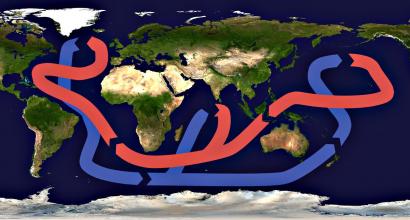
Pontus Euxinus - Scythian Sea
Crimea became known for world history many centuries before our era. In ancient times, the peninsula was called Taurica. This name was recorded by the Byzantine historian of the VI century AD Procopius nz Caesarea. The Old Russian chronicle "The Tale of Bygone Years" gives a slightly modified form of this name - Tavriania. Only in the XII century, the Tatars, who conquered the peninsula, called the Greek city of Solkhat (now Stary Krym) Crimea, which became the center of their possessions. Gradually, during the XIV-XV centuries, this name spread to the entire peninsula. The names of the Greek colonies that arose in the Crimea in the VI century BC. cannot be considered the oldest Crimean toponyms. Before the arrival of the Greeks in the Crimea, numerous tribes lived here, leaving their mark on history, archeology, and toponymy.
Crimea belongs to those few places on earth where people have appeared since time immemorial. Here, archaeologists discovered their sites of the Paleolithic era - the early Stone Age.
Scientists believe that before the beginning of the divergence of peoples - about 3700 BC. throughout the Caspian steppes of Eastern Europe and Western Asia, the common language of communication was, the roots of which lie in.
The roots of the most ancient names of the Crimean places, rivers, mountains, lakes should be sought in the Proto-Indo-European language - Vedic Sanskrit: support, stronghold, tower, tower, pylon.(a related word in Old Russian: KROM - castle, fortification, secluded, hidden from ...; Kromny - outer edge (edge); KROMA - edge, piece of bread;) At the root of the word Kram - kram - fortress, verb " kR" and "krta" - create, build, make, that is - this is a man-made structure - the Fortress, the Kremlin.
Slavic historian, archaeologist, ethnographer and linguist, author of the 11-volume encyclopedia "Slavic Antiquities" Lubora Niederle claimed that “... among the northern neighbors of the Scythians mentioned by Herodotus, not only the neurons ... but also Scythians called plowmen and farmers ... were undoubtedly Slavs, who were influenced by the Greco-Scythian culture.

The first population of Crimea known to us from ancient Greek sources was the Scythians, Taurus and the Cimmerians, who were related or Thracian.

In the southwestern part of the Crimean peninsula, 15 km from Sevastopol, there is ancient city balaclava, with a rich history spanning over 2500 years.
Since ancient times, it has been a powerful military fortress created by nature itself. Balaklava harbor is closed by high rocks on all sides from sea storms, and the narrow entrance to the harbor reliably protects it from enemy invasions from the sea. reports that Tauris lived in the mountains of Taurida, who knew a lot about martial arts.

There are two toponyms within the Dnieper Left Bank ancient Slavic species - Perekop, near Sreznevsky - Perekop, possible calque of relict Indo-Aryan * krta - “made (that is, dug by hand)” , hence the name Crimea. Approximately in the same place, at the base of the Crimean peninsula, there is another Russian. Oleshye , one of the "populated places" by the sea, which from time immemorial - from Herodotus Hylaea ('Y - "forest") up to the present Aleshkovsky (!) Sands - steadfastly conveyed and preserved the image of this "wooded" patch among the surrounding treeless spaces.
The name "Balaklava" comes from the word, strength, power, energy, strength, military force, army, army. The word "Bala" comes from - RV). Perhaps the name of the harbor "Bala + Klava" - comes from "Bala" - military, "Klap, kalpate" - klṛ p, kalpate - "strengthen, strengthen, fortress" (from the root "kḷ p"), that is - Military Fortress.
The ancient Greek geographer and historian Strabo (64 BC - 24 AD) and the Roman writer, author of Natural History Pliny the Elder (23-79 AD) associated the name of the harbor and military fortress with the name of their son (II century BC) Palak - "strong warrior." Names of the god of war ancient greece - Pallas (Pallas), an epithet of a goddess Athena Palada(other Greek Παλλὰς Ἀθηνᾶ) – militant goddess of war strategy and wisdom, and the name of the Scythian prince Palak - "warrior", come from the same root.

In the 5th century, on both banks of the Kerch Strait, a powerful arose, the inhabitants of which consisted of representatives of various peoples - Greek colonists, Scythians, Meots. Dominant dynasty The Spartakids were of Thracian origin, and the royal guard also consisted of the Thracians. The roots of the language of the Scythians, Cimmerians, Greeks lie in the Proto-Indo-European language, which is why they found a common language and, allowing for the interpenetration of cultures and language borrowings on the peninsula, for example, from the Germanic tribes - - the Scythians, who were in a single Gothic union of tribes in the Crimea .
The role of the Goths in the life of the Crimea was very significant, since even in the Byzantine medieval sources the Crimea was called Gothia. belongs to the Indo-European group of languages. A few fortified Ostrogothic settlements remained in the Black Sea region in the western mountainous part of the Crimea, inhabited by Greeks and subordinated to Byzantium, and also from the 5th century in the Sea of \u200b\u200bAzov on the Taman Peninsula, the Ostrogoths at the end of the 4th century were cut off by the invasion of the Huns and other nomads in the Black Sea region. Byzantine Emperor Justinian I built a line of fortifications in the Crimea to protect the settlements of the Ostrogoths (Eastern Goths). In Taurida (Crimea) there was a Gothic the fortress city of Mangup, the cities of Doro (Doros), Theodoro, ready-meal merchants living on the "table mountain" (near Alushta).

In the 6th century, the Crimean Goths adopted Orthodox Christianity and patronage from Byzantium. The Crimean-Gothic language was preserved in the Crimea for a long time, dating back to the Ostrogothic dialect. tribes of the Eastern Goths, who came to the Black Sea and the Sea of \u200b\u200bAzov in 150 - 235, and living in the neighborhood with Greek settlers and Scythians. Flemish monk V. Rubruk, who testifies in 1253 that the Goths in the Crimea at that time they spoke the "Germanic dialect" ( idioma Teutonicum - "Taurian language").
Distribution of power Kiev princes Ancient Russia on a fairly large part of the peninsula closely and for a long time brought the population of Crimea closer to the ancient Russian state. There were gates of sorts through which Kievan Rus went out to communicate with the countries of the East. In the first centuries of our era in the Crimea appeared Slavs. Their migration to the peninsula is most naturally explained by the so-called great migration of peoples in the II-VII centuries.
From time to time, Byzantine sources recall the Slavs in Tavria. But scientists were able to get a more complete picture of their life on the peninsula only starting from the era of Kievan Rus. Archaeologists have discovered in the Crimea the remains of material culture, foundations architectural structures, close to those that were built in the cities of Kievan Rus. Moreover, the fresco paintings and the plaster itself of the Crimean Russian churches are very similar in composition to the fresco paintings of the Kiev cathedrals of the 11th-12th centuries.
Much about the ancient Russian population of the Crimea becomes known from written sources. From "The Lives of Stefan of Surozh" know that at the beginning 9th century Russian prince Bravlin took possession Crimean cities Korsun (or Kherson, so in the Middle Ages Chersonesus began to be called) and Sudak. And in the middle of the same century, the ancient Russians settled for a long time in the Sea of \u200b\u200bAzov, having mastered the Byzantine city Tamatarkhoy later Tmutarakan, the capital of the future ancient Russian principality of Tmutarakan, part of whose land stretched in the Crimea. Gradually Russian principality spreads its power northwestern part of it on the outskirts of Kherson, the entire Kerch Peninsula.

Tmutarakans principality formed in the middle of the 10th century. Remote from other Russian lands, it was under constant pressure from Byzantium, but managed to survive. Successful Vladimir Svyatoslavich's campaign against Kherson in 989 expanded ancient Russian possessions in the Crimea. According to the Russian-Byzantine agreement, Kievan Rus was able to annex the city of Bosporus with its outskirts to the Tmutarakan principality, which received the Russian name Korchev (from the word "wrath" - a forge, the current Kerch).
On the Taman Peninsula, a Tmutarakan stone was found, on which an inscription was carved that in 1068 Russian prince Gleb Svyatoslavovich “I measured the sea on ice from Tmutarakan to Korchevo. 10,000 fathoms and 4,000 fathoms.
The Arab geographer Idrisi called Kerch Strait "the mouth of the Russian river". There he even knew a city with the name "Russia". Medieval European and Oriental geographic Maps Crimea recorded a lot of place names, names of cities and settlements, indicating a long and long stay of the Russians in the Crimea: " Cosal di Rosia", "Rossia", "Rosmofar", "Rosso", "Rossika" (the latter near Evpatoria), etc.
At the end of the 12th century, a mass of nomadic Polovtsy, who took possession of the steppes of the northern Black Sea region, cut Crimea off from Kievan Rus for a long time. At the same time, the Polovtsians destroyed the Tmutarakan principality, but a significant part of the Russian population remained on the peninsula. One of its strongholds was city of Sudak(Russian name Surozh). According to the Arab writer Ibn al-Athir. At the end of the 12th - beginning of the 13th centuries, many Russian merchants lived in the Crimea and the Black Sea was called Russian sea.
The Russian population of the peninsula, as well as representatives of other local peoples, was dealt an irreparable blow by the conquest of the peninsula Mongol-Tatars after 1223.
Crimea is a striking peninsula, a place where the history of past centuries and the present are harmoniously intertwined. Here, right in the center of modern cities, you can see the monuments of past centuries.
"Fragments" of the past in the Crimean cities
The ruins of large settlements, the remains of fortresses, burial mounds, religious buildings are found in almost every city or its environs. Most of the ancient buildings today are considered monuments of history and archeology. Many have been given the status of nature reserves; research work and museums operate.
How developed the peninsula was already in ancient times, allows you to understand the familiarity even with a short list of ancient settlements. The most famous today are the following objects:
Panticapaeum is the oldest of the Greek cities in the Crimea. Founded at the end of the 7th century BC, it is located in the center of modern Kerch. To see his remains, you need to climb a high staircase of 500 steps leading to Mount Mithridates.
And 11 kilometers from Panticapaeum, the ruins of the ancient Bosporan settlement of Tiritaka were found.
Chersonese Tauride - the ruins of another Greek settlement, one of the sights of Sevastopol. The foundation of this colony dates back to the fifth century BC. Chersonese was a large, well-fortified city.
Remains are preserved here to this day. ancient temple, the ruins of a theater where, according to legend, gladiator fights were fought, a mint, a defensive tower. In the church of Chersonese, Prince Vladimir, the Baptist of All Russia, was baptized.
Scythian Naples is an ancient settlement on the outskirts of Simferopol. Created in the III century BC. e., the city served as the capital of the Scythian state. Today, on the territory of the ancient tract, a defensive tower and the mausoleum of King Skilur have been preserved.
Ruskofil-Kale - a castle in the area Big Yalta, built in the XIII-XIV centuries - a fortification with an area of about 450 sq.m.
Kerkinitida is a Greek city built at the beginning of the 5th century BC. e. and lasted until the end of the II century BC. e. Its ruins are located in the center of Evpatoria, on the Quarantine Cape. Although most of The ancient settlement has been filled in, two of its sections are well-groomed and museumified.
Kalos-Limen - the ruins of an ancient Greek settlement founded in the 4th century. BC e. in the village of Chernomorskoye.
Kimmerik - a Cimmerian tract of the 6th - 5th centuries BC. e., located between Lake Elken and Mount Opuk.
The Scythian Ust-Alma settlement is one of the largest Scythian settlements of the 2nd century BC. e., located on Cape Kremenchik.
Cave and underwater cities of Crimea
Ancient cave cities belong to a separate category. Mangup-Kale - a Byzantine defensive fort of the sixth century BC, Chufut-Kale near Bakhchisaray, Kacha-Kalyon, Kyz-Kermen, others - these villages were created in the rocks. Houses, utility rooms, temples, defensive walls were cut down directly in the rock.
Crimea even has its own Atlantis - the underwater city of Acre. A small ancient Greek village, which served, among other things, as a port, existed near Cape Takil in the 6th century BC. e. ‒ 4th century AD e. Later, the sinking of the coast led to the flooding of most of the city.
Travelers with diving skills can see the ruins of Acre. Diving is possible with specialized excursions in summer time.
Note to tourists
A visit to the excavations of ancient cities can be easily combined with other types of recreation:
excursion activities;
visiting unique natural monuments;
beach recreation.
On the territory of the peninsula there are many ancient defensive towers, forts, and other fortifications that have been preserved in excellent condition. On the territory of many of them bright events are held. In particular, thematic festivals are held annually in the Genoese fortress, and reconstructions of medieval battles are staged.
Throughout the peninsula there are numerous hotels, hotels, boarding houses. Room reservations are available online. Pricing policy depends on the region, level of service and visiting season.