Lake Ladoga: description, depth, relief, fish. Lake Ladoga: facts Why you need to visit Lake Ladoga
Lake Ladoga is a lake in Karelia (northern and eastern shore) and Leningrad region(west, south and south-east shore), the largest freshwater lake in Europe. Belongs to the Baltic Sea basin Atlantic Ocean. The area of the lake without islands ranges from 17.6 thousand km 2 (with islands 18.1 thousand km 2); volume of water mass - 908 km 3; length from south to north is 219 km, greatest width is 138 km. The depth varies unevenly: in the northern part it ranges from 70 to 230 m, in the southern part - from 20 to 70 m. On the shores of Lake Ladoga there are the cities of Priozersk, Novaya Ladoga, Shlisselburg in the Leningrad region, Sortavala, Pitkyaranta, Lakhdenpokhya in Karelia. 35 rivers flow into Lake Ladoga, but only one originates - the Neva. In the southern half of the lake there are three large bays: Svirskaya, Volkhovskaya and Shlisselburgskaya bays. Climate The climate over Lake Ladoga is temperate, transitional from temperate continental to temperate maritime. This type of climate is explained by the geographical location and atmospheric circulation characteristic of the Leningrad region. This is due to the relatively small amount of solar heat entering the earth's surface and atmosphere. Due to the small amount of solar heat, moisture evaporates slowly. There are an average of 62 sunny days per year. Therefore, for most of the year, days with cloudy, cloudy weather and diffuse lighting predominate. Day length varies from 5 hours 51 minutes at the winter solstice to 18 hours 50 minutes at the summer solstice. The so-called “white nights” are observed over the lake, occurring on May 25-26, when the sun drops below the horizon by no more than 9°, and the evening twilight practically merges with the morning. The white nights end on July 16-17. In total, the duration of white nights is more than 50 days. The amplitude of the average monthly amounts of direct solar radiation on a horizontal surface under clear skies ranges from 25 MJ/m2 in December to 686 MJ/m2 in June. Cloudiness reduces, on average, the annual total solar radiation by 21%, and direct solar radiation by 60%. The average annual total radiation is 3156 MJ/m2. The number of hours of sunshine is 1628 per year.
Noticeable impact on climatic conditions the lake itself does. This is characterized by a smoothing of extreme values of climatic characteristics, as a result of which continental air masses, passing over the surface of the lake, acquire the character of marine ones air masses. average temperature air in the area of Lake Ladoga +3.2 °C. The average temperature of the coldest month (February) is?8.8 °C, the warmest (July) is +16.3 °C. The average annual precipitation is 475 mm. The lowest monthly precipitation falls in February - March (24 mm), the highest in September (58 mm). During the year, western and southwestern winds prevail in most of Lake Ladoga. The average monthly wind speed in the open part of the lake and on most islands from October to January - February is 6-9 m/s, in other months 4-7 m/s. On the coast, the average monthly wind speed varies from 3 to 5 m/s. Calms are rare. In October, storm winds with speeds of more than 20 m/s are often observed on Lake Ladoga, maximum speed wind reaches 34 m/s. Breezes are observed along the entire coast in summer on calm days sunny days and clear nights. The lake breeze begins around 9 am and continues until 8 pm, its speed is 2-6 m/s; it extends 9-15 km inland. Fogs are observed most often in spring, late summer and autumn.


The bottom topography of Lake Ladoga is characterized by an increase in depth from south to north. The depth varies unevenly: in the northern part it ranges from 70 to 230 m, in the southern part - from 20 to 70 m. The average depth of the lake is 50 m, the greatest is 233 m (north of the island of Valaam). The bottom of the northern part is uneven, furrowed with depressions, and the southern part is calmer and more smooth. Lake Ladoga ranks eighth among the deepest lakes in Russia. Transparency west coast Lake Ladoga 2-2.5 m, near the eastern coast 1-2 m, in the estuarine areas 0.3-0.9 m, and towards the center of the lake it increases to 4.5 m. The lowest transparency was observed in Volkhov Bay (0.5 -1 m), and the highest is to the west of the Valaam Islands (8-9 in summer, over 10 m in winter). There is constant unrest on the lake. During strong storms, the water “boils” in it, and the waves are almost completely covered with foam. The water regime is characterized by surge phenomena (water level fluctuations by 50-70 cm annually, up to a maximum of 3 m), seiches (up to 3-4 m), wave heights during storms up to 6 m. The lake freezes in December (coastal part) - February (central part), opens in April - May. The central part is covered with solid ice only in very severe winters. Due to the long and strong cooling in winter, the water in the lake is very cold in summer; it warms up only in the thin upper layer and in the coastal strip. The temperature regime differs in the central deep-water part of the lake and on the coast. The water temperature on the surface in August is up to 24 °C in the south, 18-20 °C in the center, at the bottom about 4 °C, in winter under the ice 0-2 °C. The water is fresh and clean (except for areas polluted by industrial waste), minerals and salts are dissolved in negligible quantities. The water belongs to the hydrocarbonate class (low content of calcium and magnesium salts, slightly more nickel and aluminum).


In Lake Ladoga, 378 species and varieties of planktonic animals were identified. More than half of the species are rotifers. A quarter of the total number of species is made up of protozoa, and 23 percent falls jointly on Cladocera and Copepods. The most common zooplankton species in the lake are Daphnia and Cyclops. A large group of aquatic invertebrate animals lives at the bottom of the lake. In Ladoga, 385 species were found (mostly various crustaceans). The first place in the benthofauna belongs to insect larvae, which account for more than half of all species of benthic animals - 202 species. Next come worms (66 species), water mites, or hydrocarines, mollusks, crustaceans and others. The lake is rich in freshwater fish, which go into the rivers to spawn. Lake Ladoga is home to 53 species and varieties of fish: Ladoga slingshot, salmon, trout, palia, whitefish, vendace, smelt, bream, raw fish, bluefish, silver bream, rudd, asp, catfish, pike perch, roach, perch, pike, burbot and others . Human impact on the reservoir reduces the number of valuable fish - salmon, trout, palia, lake-river whitefish and others, and the Atlantic sturgeon and Volkhov whitefish are listed in the Red Book of Russia. The most productive areas include the shallow southern part of the lake with depths of up to 15-20 m, where the main fishery is concentrated, and the least productive areas include the northern skerry area. Sturgeon passes through the lake from the Gulf of Finland along the Neva to spawn in the Volkhov and other rivers. Along the southern and southeastern shores of Lake Ladoga there is pike perch. The lake is inhabited by salmon, which in the fall go to the rivers where they spawn. Whitefish, Siberian sturgeon and other fish are bred in Lake Ladoga and Volkhov. In the Ladoga region, 256 species of birds belonging to 17 orders are regularly found. More than 50 bird species have been recorded here during transit migration in spring and autumn. Migration connections of the Ladoga region cover the space from Iceland to India and from South Africa to Novaya Zemlya. The most attractive areas for birds are the southern Ladoga region. Grebes, swans, geese, ducks, waders, gulls, terns, cranes and rails are found here on migration, as well as nesting sites of dabbling ducks, tufted ducks, red-headed pochards, gulls, terns, great and middle curlews, godwit, grass-billed plover, golden plover and other waders, gray crane, white-tailed eagle, osprey, falcon, eagle owl, great gray owl, short-eared owl and a number of other birds. The northern skerries are a nesting site for gray-cheeked grebe, great and common mergansers, gulls (including sea gulls and black-billed gulls), terns (including arctic terns), waders and many other species; aggregations of arctic ducks and waders are observed on migration. Lake Ladoga is home to the only representative of pinnipeds, the Ladoga ringed seal. The number of seals in the lake is estimated at 4000-5000 heads (according to 2000 data). The species is listed in the Red Book.

And meridians 29°48 and 32°58` east longitude from Grinich. With an oval shape, somewhat pointed to the north, the lake stretches almost along the meridian, in the direction of which it has greatest length 196.5 kilometers. The greatest width of the lake is almost in the middle of its length, at the parallel of 61° north latitude, and between the mouths of Vuoksa and Olonka, 124 kilometers.
To the north, the shores of the lake quickly narrow and end in the Hien-Selke Bay, and to the south, the shores narrow slowly and end in the vast Shlisselburg and Volkhov bays, separated by a wide ledge. The length of the coastline is 1071 km, of which 460 km, occupying part of the western bank, from the border with the Polutorny stream to the source of the Neva, the entire southern bank and part of the eastern bank to the village of Pogranichnye Konduzhi belong to Russia, the remaining 610 km. belong to Finland.
The surface of the lake, including the islands, is 15923 km2, of which 8881.1 km2 in Russia and 7041.6 km2 in Finland. While inferior in size to the large lakes of America, Lake Ladoga is significantly larger than all European lakes: it is twice as large, three times larger than Venus, five times larger and ten times larger than Saimaa, not to mention the rest of the Western European lakes.
Lake Ladoga serves as a receiver for a huge amount of water, the only one of which is the high-water Neva, flowing from the southwestern corner of the lake in two branches, separated by Orekhov Island, and flowing into St. Petersburg. Of the tributaries directly flowing into Lake Ladoga, the following are remarkable: in the western part of the lake: the Vuoksa River, flowing from Lake Saimaa and forming famous waterfall Imatru, flows into Lake Ladoga partly directly at Kexholm, partly through Lake Suvanto by the Taipala River; in the northern part: Gellul, Lyaskil, Uksu, Tuloma, and Minol; in the eastern part: Vidlitsa, Tuloksa, Olonka, Obzha, Svir with Oyat and Pasha and Voronega; in the southern part: Sias with Tikhvinka, Volkhov, Kobona, Lava, Sheldikha and Nazya. The tributaries of the Volkhov, Syas and Svir serve as the beginning of three water systems: Vyshnevolotskaya, Tikhvinskaya and Mariinskaya, connecting Lake Ladoga with the Volga basin, and each of the named rivers, together with the rest of the southern rivers, when they flow into the lake, is connected or intersected by old and new bypasses Ladoga canals, which stretch along the entire southern and often eastern shore of the lake, from the source of the Neva to the mouth of the Svir.
With the help of its numerous tributaries, Lake Ladoga captures, in addition to parts of Finland, St. Petersburg and Olonets, almost all of Novgorod and some parts of Pskov, Vitebsk, Tver and Arkhangelsk regions. The Ladoga basin contains a space of 250,280.3 km2. Although Lake Ladoga, located between the basin and and, occupies a very advantageous position, and in terms of its vastness, depth and excellent navigation conditions it itself constitutes an inland sea, but its navigation and trade and economic importance are extremely insignificant, due to the bypass Ladoga canals, which made the construction of marine-type vessels necessary for navigation in the lake completely unnecessary.

Bay, Lake Ladoga and rocks (photo by Oleg Semenenko)
Shores of Lake Ladoga. From the mouth of the Vuoksa to the source of the Neva, the coast consists of clay and loamy sediments, bordered by sandy soil, with numerous boulders. Up to the mouth of Taipala, the coast is still quite elevated, but further to the south there is a low-lying desert coast, partly sandy and partly covered with thick grass. The southern coast of the lake, between the source of the Neva and the mouth of the Svir, is low-lying, almost treeless and consists of clayey and swampy soil; formed by sediment from rivers flowing into the lake, it is bounded from the south by an elevated ridge of limestones of the Silurian system, which, in all likelihood, was once the shore of Lake Ladoga. Currently, they are located at a distance of 3 to 30 kilometers from it, and only near the mouth of the Svir the limestones with their rocky cliffs cut like a wedge into the shore of the lake, towards Cape Storozhensky, forming the outskirts of a peninsula that protrudes far into the lake.
Eastern coast, from the mouth of the Svir to lake. Karkun-lamba, at first low-lying and partly swampy, gradually rises and consists of clayey and loamy soil, which on the very coastline turns into purely sandy. The coastal area of the northwestern part of the lake is in complete contrast to the southeastern part. Here the shores and those adjacent to them are elevated, rocky and consist mainly of granite, partly gneiss, syenite and other crystalline rocks, as well as various types of marble.
From Kexholm to the north and further east to Impilax, the granite gradually changes from light gray and coarse-grained to bluish-gray and fine-grained, very strong and hard, then, to Pitkerando, it turns reddish, but south of Pitkerando the granite completely disappears from the surface land, and the soil is sandy-clayey, filled with boulders different types, and granite is found only in low-lying capes protruding into the lake, consisting of fine-grained red granite.
Islands in their composition and height they correspond to the shore near which they are located. Almost all the islands in the northern part of the lake are elevated, consisting mainly of granite and hard rock, while the islands in the southern part are low-lying, partly marshy and surrounded by shallows and reefs. Thanks to the many islands and significant ruggedness of the shores, the northern part of the lake is very rich in bays and bays sheltered from the winds, which are very convenient places for a quiet anchorage of ships, but in the southern part of the lake there are almost no such places, as a result of which ships here, in strong winds, forced to settle in an open lake, mainly in the open and dangerous Koshkinsky roadstead.
Of the islands in the northern part of the lake, near the shores, the most remarkable are: the island of Kuko-sari, lying at the mouth of the Vuoksi River. In the Kronober Bay: Kilpodan, Korpan and Teposari, the last two of which form the entrance to the bay, which is a vast bay, completely calm for ships. The island of Sarolin, which makes up the left shore of Yakimvar Bay, is 12 km away. jutting out into the mainland and representing a safe bay with all sorts of conditions.
Of the islands in the middle of the northern part of the lake, the following stand out: the Valaam group, consisting of 40 islands that stretch parallel, at a distance of about 20 km. from the extreme islands of the northern skerries. The main and largest of this group is the island of Valaam (26.2 km2), which has a very irregular shape, but with the closely adjacent islands of Skitsky, Predtechensky and Nikonovsky, it appears in the form of an equilateral triangle. In its northwestern part, on a rock, the Valaam-Preobrazhensky Monastery is located, in the depths of the bay, with a convenient pier. To the east of Valaam stretch the islands: Baiovye and Krestovye. To the southwest of the island: Gange-pa with a lighthouse, Muarka, Yalaya and Rahma-sari, lying almost on the same parallel. To the south are the islands: Suri Verko-sari and Voschaty or Vasiya-sari. To the south of this last island lies Konevets (6.5 km2), on which the Konevsky-Rozhdestvensky Monastery is located.

Lake Ladoga (photo by Dmitry Savin)
Depth Lake Ladoga is generally quite significant; distributed unevenly, depending on the height of the banks: the steeper and more elevated the shores adjacent to the water's edge, the greater the depth and vice versa. From the southern low-lying shore, the depth, starting from half a meter, slowly and gradually increases; having passed the reefs and shoals protruding from this shore, it begins to quickly increase, so that in the middle of the lake it is from 60 to 110 m, further to the north it increases to 140, and in some places reaches 200 meters. Thus Ladoga bottom has a very significant slope from south to north, and it consists of a series of more or less irregular ledges, on which in some places there are significant mounds and hills, in places there are depressions and basins. Thus, between the lines of equal depths of 60 and 80 m, there are bottom elevations at which the depth is only 32 m, and in the northwestern part of the lake, between the lines of equal depths of 10 and 140 m, there are depths of 200 or more m.
Water level and currents. The water level of Lake Ladoga is subject to constant fluctuations, depending on the totality of all meteorological circumstances in the entire basin of the lake, as a result of which the height of lake water not only in different years, but also at different times of the same year can be very different. Since time immemorial, the existing belief about the seven-year periodicity of changes in the lake water level, according to which the lake water horizon constantly seems to rise for 7 years, and constantly decreases over the next 7 years, was completely refuted by 14-year observations, which were produced on the island of Valaam and of which there was no correctness in changing the position of the water level.
Opening and freezing. First of all, the shallow southern part of the lake is covered with thin ice, usually in early November, sometimes at the end of October, at a temperature of about 5 degrees Celsius. This thin ice or lard is carried by the current into the Neva, where the autumn ice drift begins and does not last long. In the lake itself, with increasing frosts, the entire southern part of the lake is covered with ice, both at the very shore and in the space between the reefs and shoals protruding from it. Further, to the north of the parallel of the Sukhsky lighthouse, under the influence of winds that easily break up the formed ice, the lake does not freeze for a long time, and at great depths in the northern part it freezes only in December, often in January, in other years the middle of the lake remains unfrozen all winter .
In general, the lake is covered with solid ice only in the most severe winters; during ordinary frosts, only the outskirts, 20-30 kilometers from the shores, are covered with ice. Determining whether the middle of the lake is frozen or not seems to be quite difficult, due to the distance of the middle of the lake from the shore. Fishermen who carry out ice seine fishing determine this with great accuracy by the current in the ice holes: if in the ice holes there is a current corresponding to the direction of the wind, then the middle of the lake remains unfrozen, but the absence of a current shows that the entire lake is covered with solid ice.
The opening of Lake Ladoga, like freezing, also begins at the southern shore of the lake, usually at the end of March - the first half of April, simultaneously with the opening of southern tributaries and warm water, which has a direct impact on the opening of the Neva, which always begins from the source, near Shlisselburg , and there are two ice drifts on it: the river itself, which does not last long, and the very long Ladoga ice drift, which almost never passes at once.
Lake Ladoga, the largest freshwater lake in Europe, is located in northwestern Russia, in a rugged region with majestic nature and rich history. It was here that Russian statehood was born and the first Russian cities appeared.
The history of the lake, the unique and rich nature - all this makes Lake Ladoga a most valuable cultural object and a beautiful corner of Russia.
Origin of the lake
The lake was formed by the melting of a glacier, and this process lasted several thousand years. Several times the giant lake either merged with the waters of the ancient ocean, or again found itself surrounded by the firmament. Finally, about three thousand years ago, a body of water, pressed by its banks, broke through to Baltic Sea the Neva River.
The gradual formation of the lake was reflected in the unique bottom topography: if in the northern part of the lake the depth reaches 230 m, then in the “shallow” southern part it is 20-70 m. The difference in landscape is also explained by the fact that the reservoir belongs to different natural areas. The Karelian (northern) coast lies on the Baltic crystalline shield, it is steep and rocky. South coast, located in the Leningrad region, consists of sedimentary rocks. The coast gently goes under water, forming sandbanks and beaches.
Lake Ladoga on the map looks like the footprint of some giant beast. The length of the reservoir from north to south is 219 km, and from west to east – 138 km. The huge area of the lake is over 18,000 square meters. km – holds about 900 cubic meters. km of water. More than 40 rivers and streams fill it with their waters, and only one - the deep Neva - flows out. Some rivers connect Lake Ladoga with other lakes - Onega, Ilmen, Saimaa.

There are many islands on the lake - more than 660. In the north of the lake are the famous Ladoga skerries - a magnificent necklace of a series of rocky islands separated by narrow straits. The main diamond of this stunning unique beauty natural phenomenon- the holy island of Valaam with the famous Spaso-Preobrazhensky Monastery.
History of the lake
Lake Ladoga occupies a special place in the history of our country. The name of the reservoir comes from the name of the ancient Russian city of Ladoga, but there is another version: on the contrary, the city is named after the lake. Until the 13th century, the lake was called “Great Lake Nevo.” In Finnish, the word “nevo” means “swamp”, “quagmire”.
 Fateful events reflected in culture and history are associated with Lake Ladoga:
- the famous route from the Varangians to the Greeks passed through Ladoga;
- in the 14th century, Oreshek, the oldest Russian fortress, was built at the sources of the Neva;
- at the end of the 14th century, the largest Orthodox monasteries were built on the islands - Valaam and Konevsky, famous for their missionary activities;
- Novgorodians kept a navy here;
- battles of the Northern War of 1701-1721 took place on the lake and its shores;
- The road of life during the Second World War.
Since 1721, the coast of Lake Ladoga became completely Russian. Even then, Peter I appreciated the harsh nature of the lake, its treachery: complete calm in a few tens of minutes can give way to a real storm, and the waves rise to a height of 4-5 meters. Such inconstancy of the lake forced the Russian emperor to say the famous words that only the one who walked on Ladoga can be considered a real sailor.
The road of life
The history of the lake has tragic pages that evoke tears of joy and grief at the same time - this is a heroic chronicle of the salvation of hundreds of thousands of human lives from besieged Leningrad during the Great Patriotic War.
The road of life across Lake Ladoga connected the dying city with the country and saved it from death. Between September 1941 and March 1944, 1,600 thousand tons of various cargo were transported across the water and ice of the lake and more than 1,300 thousand people were evacuated.

In winter, goods and people were transported on the famous “one and a half trucks” - GAZ-AA. With the melting of the ice, navigation by water began. In addition to 15 barges, metal ships took part in navigation, the construction of which was carried out in Leningrad.
The road of life passed near the front line and needed protection. It was defended by anti-aircraft artillery divisions and fighter regiments, but thin ice and bombing destroyed about a thousand trucks.
In memory of the feat of the Soviet people on the Road of Life, 7 monuments and 112 memorial pillars along the highway and railway were erected in the territory from Leningrad to Ladoga. The most famous of the monuments is “The Broken Ring” by architect V. G. Filippov. 
Why you need to visit Lake Ladoga
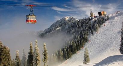
Ladoga is one of the many water bodies in our country, visiting which will bring great pleasure. From year to year, in any season, thousands of fishermen, pilgrims and simply vacationers flock to the shores of the lake. Each of them has their own interests, but no one is left indifferent by the stunning beauty of the water surface, quaint islands, majestic shores and, of course, the harsh character of the lake. You need to make friends with him, and then your relationship with the lake will last for many years, bringing a lot of impressions.

So why is it worth visiting the shores of a wonderful lake? Here are probably the main reasons:
- . The lake is home to over 50 species of fish, the most famous of which are salmon, whitefish, Ladoga smelt, and pike perch. You can fish at any time of the year with consistently excellent results.
- Rich flora and fauna. The nature of Lake Ladoga is unique and diverse: here you can find southern plant species and tundra flora; Hares, wolves, bears, moose and other species of animals live in the forests, and the Ladoga seal lives in the north of the lake.
- Diving. Thanks to the fresh and clean water, its low temperature, the artifacts of bygone times lying on the bottom are perfectly preserved and are of scientific and research interest.
- Curious natural phenomena: mirages, brontides (underground rumble).
- Visiting holy places.
- Developed tourist infrastructure.
- Relax on sandy beaches.
- Complete absence of mosquitoes.

Lake Ladoga - mysterious, majestic and beautiful, will always attract thousands of tourists eager to experience its harsh beauty. The wealth of waters and shores, the bizarre landscape and history of the lake stuns the imagination and fills hearts with love for Russia, its nature and culture.
Page 1
For all the great lakes, except Pskov-Chudskoye, Lake Ladoga is the last one. Therefore, its basin is very large: 258.6 thousand km2. (Ivanova and Kirillova, 1966). This basin contains about 50,000 smaller lakes, many swamps and 3,500 rivers (each more than 10 km long); the total length of the rivers is about 45,000 km (Nezhikhovsky, 1955). The marshes and complex lake systems of the basin regulate the flow into Lake Ladoga and its water regime. Rivers, passing through intermediate lakes, leave in them a lot of suspended mineral particles they carry and reach Ladoga with noticeably clarified water. River floods spread out onto lakes.
The Neva does not become shallow at any time of the year, and there are no floods on it. Fluctuations in the level of the river depend mainly on the surge and surge winds. With strong winds blowing downstream of the river, the water level can drop by 1 meter; with surge winds from the Gulf of Finland, the level sometimes rises to dangerous levels, and Leningrad is subject to floods. The Neva is original not only for its full flow and its hydrological regime. Unlike normal rivers, it does not have real river terraces, nor does it have a real delta. Typically, river deltas arise as a result of the deposition at the mouth of a river of the sediment that the river carries. But in the Neva, flowing from such a huge sedimentation basin as Lake Ladoga, there is very little sediment. Consequently, the settling of silt at the mouth of the Neva could not lead to the formation of a delta in the usual way.
And the Neva delta, consisting of 101 islands and occupying an area of 83 km2, arose differently. The Baltic Sea was once larger than it is now. Shrinking in volume and retreating westward from the mouth of the Neva, it drained the coastal shallows and turned them into islands. The Neva waters rushed between the islands, and the river began to flow into the sea not in one, as before, but in several branches. This is how the “delta” turned out. It was formed approximately 2000 years ago.
As already noted, the northern part of Lake Ladoga lies on the Baltic crystalline shield, the southern part on the Russian Platform. The southern border of the shield in the areas closest to Ladoga runs approximately along the line Vyborg - Priozersk - the mouth of the river. Vidlitsy - the source of the river. Sviri.
The ancient rocks that make up the Baltic Shield emerge on the surface, being covered in places by only a thin (several meters) layer of loose Quaternary sediments. Among the Archean rocks, the main place in the structure of the shield is occupied by various granites, migmatites, gneisses, and crystalline schists. Gneisses, shales, quartzites, sandstones, conglomerates, crystalline and dolomitized limestones, as well as tuffaceous and volcanic rocks form the Proterozoic sedimentary complex.
Igneous rocks of the same age include gabbro, gabbro-diabase and diabase intrusions. On the northwestern and northeastern coasts of Lake Ladoga there are numerous outcrops of migmatites, gneisses, crystalline schists, and rappakivi granites; The Valaam archipelago and the group of islands Mantsinsari and Lunkulansari are composed of olivine diabases.
To the south of the Baltic shield, Early Cambrian deposits of the Russian Platform are exposed on the surface in the area of Lake Ladoga, which, unlike the shield, was repeatedly covered by the sea in Paleozoic times. The Cambrian sequence is represented by two complexes: the Valdai, developed everywhere and consisting of variegated sandstones and thin-layered shales, and the Baltic, composed of sandstones, sands and plastic blue clays, so fine-grained and greasy that they were sometimes used instead of soap when washing clothes.
More on geography:
Mining industry
Krivoy Rog is a city in the Dnepropetrovsk region with a predominant development of the mining industry. On the basis of iron ore mining in Krivoy Rog, metallurgical and industrial development began. A number of related industries were created. In particular, a cement mining plant was built, providing raw materials for...
Internal and external migrations
Currently, the number of labor migrations associated with unemployment has increased. They mainly migrate to developed and developing countries. Migration in India has always played a big role in the life and employment of the population. During the partition of India (1947), population exchange between India and Pakistan became widespread...
Transport network
Transport system The Baltic countries have a pronounced transit character, have a developed infrastructure and play an important role in the economy. For foreign trade, railway and marine species transport. Total length railways exceeds 5.5 thousand km. Basic...
Ladoga lake is the largest freshwater lake on the European continent. For Russia, this lake has a large industrial, ecological and historical meaning. Another name option - Ladoga.
If you look at the map, you can see that the shores of Lake Ladoga belong to two Russian regions: the Republic of Karelia and the Leningrad Region. That is, it is located in the European part of the country.
On the north side Ladoga The shores are high, rocky, their relief is quite rugged, which explains the presence of a large number of peninsulas, bays, and small islands. From the south of Ladoga, the lake is surrounded by low, gentle, more even shores. The largest bays are also located here: Volkhovskaya, Svirskaya, Shlisselburgskaya bays. The eastern coast is also not very rugged; there are sandy beaches here. In the West coastline almost flat. Mixed forests and bushes grow here; there are many large stones near the water on land, which also cover the bottom under water for quite a distance.
They bring their waters into Ladoga lake There are 35 rivers, but only one flows out. The largest river that brings water is the Svir. What river flows from Lake Ladoga? This is the famous Neva, on which stands the second most important city of the Russian Federation - St. Petersburg. Some rivers bring water into Ladoga from other lakes, such as Onega or Ilmen.
There are a large number of islands on the lake - at least five hundred. The largest islands Ladoga together they constitute the Valaam archipelago. The largest single island is Riekkalansari. Also a large island is Konevets, where a famous monastery was built, just like on Valaam.

Dimensions, extent and depth of Ladoga
The depth of Lake Ladoga is uneven throughout its territory - it increases from south to north. The maximum depth of Lake Ladoga is 233 m. The average figure is much lower - 50 m. In the north of Lake Ladoga its depth varies from 70 to 230 m, and in the south - from 20 to 70.
The area of Ladoga is 17.87 thousand square meters. km. The volume of water in Lake Ladoga is 838 cubic meters. km. The length from north to south of the lake is 219 km; at its widest point, Ladoga stretches for 125 km.
Climatic features of the area
Lake Ladoga has a generally temperate climate. In the geographical area where Lake Ladoga is located, not much sunlight penetrates throughout the year. Therefore, the evaporation of water from Ladoga occurs quite slowly. Most The days of the year are cloudy and cloudy here.
Between the end of May and mid-July Lake Ladoga You can observe the famous phenomenon of “white nights”, when at night the sun practically does not set beyond the horizon.
Throughout the year, western as well as southwestern winds blow on Ladoga. In winter, Lake Ladoga freezes until the end of spring, but is completely covered with ice only in the coldest winters. This long period of glaciation affects water temperatures throughout the rest of the year. The average water temperature here is low: at depth it is 4°C, and at the surface Lake Ladoga Depending on the time of year and site, it can range from 2 °C to 24 °C. The water is not as clear as on Lake Baikal, but this may be due to the fact that many species of algae and small plankton live in it, and constant storms agitate its surface, churning up the foam.

History of Lake Ladoga
Lake Ladoga was formed as a result of the melting of glaciers and over several thousand years its outlines formed and changed.
Until the 13th century, the lake was called Nevo, which apparently was directly related to the name of the Neva River. Then it was called Lake Ladoga, taking the name from the city of Ladoga located here. Many objects in this area have names originating from the Karelian language. But the most likely explanation for the name “Ladoga” is considered to be Finnish versions - from ancient words denoting water or the concept of “lower”, which are consonant with Ladoga. The name Nevo also has Finnish roots and can mean “swamp”. It is quite possible that in those days the lake gave reason to call itself that; there are many traces of swamps in this area.
Along Lake Ladoga, starting from the 9th century, the water part of the route “From the Varangians to the Greeks” passed from Scandinavia through the territory of Europe to the country of Byzantium. In the 8th century, the city of Ladoga was built here, and soon other cities and fortresses began to appear here. At the end of the 14th century, the famous Valaam Monastery was founded on the islands of the same name; its buildings are still a pearl of wooden architecture.
For many years there was a war with the Swedish state for part of the lands lying on the shore of the lake. Peter I nevertheless managed to ensure that Ladoga became Russian. In 1721, according to an agreement with the Swedes concluded after the war, the entire coast of Lake Ladoga went to Russia.
To make navigation on Ladoga more accessible, a canal was built here.
During the difficult war years from 1939 to 1944. The Ladoga flotilla was based in Lake Ladoga and fought in its waters. In 1941–1944 more than half of the coast of Lake Ladoga was occupied by enemy troops. From September 1941 to March 1943, the “Road of Life” passed along the ice of Ladoga - the only route along which provisions and necessary things could be delivered to besieged Leningrad. The evacuation of people was also organized along it; in total, about 1.3 million people took advantage of the evacuation.
Thus, Ladoga is a lake that has special significance for Russian history.
Ecology of Lake Ladoga
Basically, the waters of Ladoga are very clean, but there are problem areas. This is largely due to the development of industrial zones near Lake Ladoga, as well as with the consequences of World War II. During the war, radioactive weapons were tested in this area and on some islands. In particular, the reaction of animals to the consequences of its use was studied. In addition, many sunken military ships and aircraft with ammunition create an unfavorable radiation background.
The number of contaminated places is growing. On the shores of Ladoga there are approximately 600 industrial enterprises that pollute the air, dump industrial waste into the Ladoga River and others, which then bring them into the lake. By the way, the correct answer to the question – Ladoga is a river or a lake is that it is both. There is a river and also a city with the same name. At the same time, historians claim that first the river received its name, then the city, and only after that Lake Nevo was renamed.
Pollution of Lake Ladoga today is considered to be at a moderate level. In some places, radiation standards are exceeded - where supplies were previously tested, as well as those closest to nuclear and other industrial enterprises.

Nature and fauna of Lake Ladoga
The nature of Lake Ladoga is very beautiful; this place is a very famous place for tourists and travelers to relax and go hiking. Majestic rocks, mountains, pine forests - this all creates unique image this place. Rare plants and animals are found in various nature reserves of Ladoga. Despite the difficult climate, even some southern plant species grow here, and in the north - typical representatives of the tundra (saxifrage). The forests on Lake Ladoga are not only coniferous, but also broad-leaved - with maples and elms.
Fauna Lake Ladoga includes representatives of the taiga: foxes, wolves, hares, bears, etc. There is also an original animal that is found only here - the Ladoga seal. The animal, which is more typical for the seas, feels great in the fresh water of Ladoga.
Lake Ladoga is home to approximately 50 species of fish. The most popular among fishermen and industrialists are smelt and pike perch.
Holidays on Lake Ladoga
Around Lake Ladoga you can find places to relax for every taste and for any purpose: recreational, hiking, entertainment. You can often meet fishing enthusiasts here. Everything you need for such activities is located at the recreation centers, including almost every one of them with instructors who will teach you the intricacies of this or that type of pastime.
People love diving here because of the large number of finds that can be found on the bottom and simply beautiful underwater views. You can also choose relaxing holiday on the beach when weather conditions permit.
Excursions to natural and historical attractions of Ladoga are also organized, for example, buildings remaining after the war, old fortresses or mountain peaks.
Attractions on Lake Ladoga
The sights of Lake Ladoga are worth talking about separately. Here is, for example, an interesting beautiful views practically untouched nature Nizhnesvirsky reserve. It is home to a huge number of bird species and many animals.
The island of Valaam on Ladoga with the monastery of the same name is of historical, cultural and architectural value. Not to mention the fact that pilgrims come here from all over Russia and beyond.
The memorial complex dedicated to the Road of Life tells the story of the heroic feat of people who, in the most dangerous conditions, traveled on the ice of Lake Ladoga, risking falling through the ice or being shot at by the enemy. Still, they did this in order to save the lives of city residents who survived the terrible siege.
Also of historical and cultural interest on Lake Ladoga are the cities of Shlisselburg, founded by Peter I, with the Oreshek fortress, and Novaya Ladoga.
Lake Ladoga in works of art
Ladoga is a lake that is reflected in folk legends and examples of folk art of the various peoples who lived here. These are mainly Karelian and Russian epics.
The famous Karelian folk composition "Kalevala", which was once passed down from mouth to mouth, describes the events that took place in the north of Lake Ladoga.
In his youth, Constantine Roerich made an expedition along the rivers flowing into Lake Ladoga and to the lake itself. From 1916, he lived in this area for two years and created several paintings, sketches, poems and fairy tales here.
Thanks to its amazing nature Lake Ladoga inspired primarily painters who were delighted with the local colors and landscapes. Many wrote about the Valaam Monastery, as its buildings looked especially impressive and mysterious against the backdrop of majestic nature. The lake with the sonorous name Ladoga also evokes fairy-tale scenes. Such masters of painting as F.A. Vasiliev, A.I. Kuindzhi, N.K. Roerich, I.I. Shishkin worked here.

Industry on the lake
The lake is used for the passage of ships whose routes along it are sections of the Volga-Baltic Route and the White Sea-Baltic Canal. The weather on the lake is very changeable and ships are often threatened by storms and high waves, so shipping is periodically suspended. Once upon a time there was even a widespread expression that if a sailor has not sailed on Ladoga, then he is not yet a real sailor. Such a phenomenon as complete calm is quite rare on this lake.
Various industrial cargo and construction materials are transported across Lake Ladoga. There are also passenger ships and cruise ships, for the most part these are tourist routes.
About 10 species of fish, such as smelt, pike perch, and whitefish, are caught here on an industrial scale. Not far from the lake there are industrial enterprises: a paper and pulp plant, aluminum, oil and chemical production, etc.
Mysteries and secrets that the bottom of Lake Ladoga keeps
At the bottom of the lake there are many interesting things for researchers and lovers of various mysteries and secrets of things. Of course, the greatest success is considered to be to find something very ancient, dating back to the Vikings. But the most common artifacts found are those left over from the Second World War. They are better preserved and easier to find. For example, the attractions of that time that attracted extreme tourists and divers included the so-called “Death Bay,” the bottom of which was practically covered with shell casings, since a fierce battle took place here in 1941.
Amateur divers find sunken ships and wartime aircraft. Unlike the sea, fresh water does not destroy and spoil sunken things so much, which is why the finds of Lake Ladoga are so attractive.