Where is the salty part of Lake Balkhash. Balkhash is an amazing lake where fresh water meets salt water
Traveling along Lake Balkhash and its main tributary, the Ili River, the Russian-Kazakh expedition found out whether the lake would be able to avoid an ecological catastrophe.
Kapchagay, Bakanas, Koskumbez. The wormwood-dusty steppe overgrown with feather grass blooms late with small poppies, purple sage pins, and pink tamarisk.
Our final goal is Lake Balkhash, we will get to it through the sands, and then along the Ili River - in the local way, Ile. The Balkhash basin stretches for 600 kilometers from west to east among poor sandy-desert plains, takyrs and solonchaks. The drainless lake is divided into two parts by the Saryesik peninsula, which formed the narrow Uzynaral strait. In the western, relatively shallow part of the lake, the water is fresh, and in the eastern, deeper part, it is brackish.
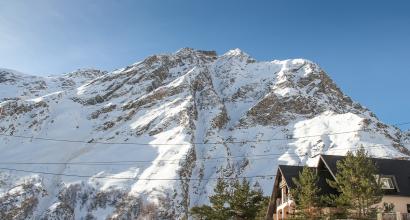
The Ili-Balkhash basin is one of the most extensive lake ecosystems on the planet, with relief heterogeneity and diversity. natural conditions. To the north and north-west of the lake is the Kazakh hilly area, adjacent to the Betpak-Dala desert - the Northern Hungry Steppe. To the south lie the sands of Saryesik-Atyrau and Taukum. In the south and southeast - the Kazakh-Dzhungar mountain region, the ridges of the Trans-Ili and Dzhungar Alatau, the Chu-Ili mountains - heavily destroyed, with flat tops.
Expeditions of Schrenk, Semenov Tien-Shansky, Przhevalsky passed here. In 1903, the future head of the Geographical Society of the USSR Lev Semenovich Berg visited Balkhash.
“In the middle of the Ili lowland, I felt myself in a completely different, peculiar climatic plant zone,” wrote Petr Petrovich Semenov Tien-Shansky. - Flora and fauna had a completely unfamiliar character to me. A lot of low and high bushes and grasses appeared before me.
Akhan Myrzakhmetov, senior researcher at the Water Resources Laboratory of the Institute of Geography of Kazakhstan, is waiting for us at night near the swampy shore Or in a time-worn cauldron. Every summer, hydrologists conduct routine research here. Achan pulls the starter, and the boat, with its nose up, roars along the black river, densely overgrown with reeds.
Or originates in the Central Tien Shan from the confluence of the Tekes and Kunges rivers. Numerous rivers and streams flowing from the slopes of the Dzungarian Alatau diverge and get lost in the sands, only the most significant carry water to Balkhash. From the south, Karatal, Aksu, Lepsy and Ili flow into the lake, providing up to 80 percent of the inflow.
Ili ends with a vast delta (8 thousand square kilometers) in the form of a triangle, the top of which is below the village of Bakanas. In total, there are two dozen settlements around the delta, no more than 100-200 families, the anthropogenic load is small. The river is divided into branches - Topar, Zhideli and a number of lake systems - Topar, Ili and others. Their watering, as well as the life of Balkhash itself, completely depends on Ili.
In 1970, in its middle course, in a narrow place of the channel, between high rocky shores, the Kapchagay reservoir was built. It was assumed that the reservoir and the hydroelectric power station would help put 400,000 hectares of land into agricultural use. Filling the reservoir with only half immediately affected the state of the entire basin. The surface area of Balkhash has decreased by more than four thousand square kilometers, and salinity in the fresh part has increased. Desertification of the delta has begun.
The lake systems were disappearing. Waterlogged areas were replaced by dry ones. The lakes turned into salt marshes, the wind carried salt dust with sand for kilometers. Drying of the floodplains led to the disappearance of animals and birds. Reeds were replaced by salt-tolerant perennials. Balkhash almost suffered the fate of the Aral Sea.
Once Balkhash had already dried up, but without human intervention. Natural secular fluctuations in the level of the lake for a thousand years were 12–14 meters, short-term - 2–4.
“Several hunters reported interesting information. According to them, Balkhash has shrunk by 2 arshins over the past 9 years. They noticed this by the retreat of water in the reeds, which were covered with water in the past, but are now completely dry ... Water on the southeastern shore of the lake, from the time of shooting in 1852, retreated 3–4 versts, that is, no less than a verst every ten years, ”wrote biologist Alexander Mikhailovich Nikolsky in 1885.
The last minimum of Balkhash fell on the 5th-10th centuries. Then the lake split into western and eastern reaches. The surface of Balkhash was below 336 meters above sea level. In the early 1980s, the Institute of Lake Science calculated that in order for Balkhash not to dry out, its level should be above 341–342 meters. From 1984 to 1989 this figure was lower. The filling of the reservoir was suspended, the flow regime of the Ili, close to natural, was restored, with the flow to the top of the delta of at least 10.8 cubic kilometers per year. This helped raise the water in the lake, but desertification and biodiversity decline continued.
Andrey Kamenev In the 1930s–1940s, the pelican colonies on Balkhash numbered over a thousand nests. Today their number has dwindled. Many areas on the islands and the coast have been mastered by fishermen and hunters.
Field Station of the Institute of Geography on the Arkhar Peninsula. Previously, hydrologists lived in a trailer, recently a solid house with a common dining room was built for them. Bauyrzhan Zhumabekov, the leading engineer of the Arkhar hospital, is the owner of the house, his wife Bota cooks in the yard for the whole horde of scientists. Under their supervision, Akhan Myrzakhmetov and the laughing Gulsayra and Lyazzat, engineers at the Water Resources Laboratory, are studying runoff losses in the Ili Delta.
“Strong water” comes from Kapchagai, Akhan explains. - It is clarified - as clarified juice is. Silt, suspensions settle in the reservoir, as in a filter. And this biological runoff nourished fertile soils. Purified water moves at a different speed, the channel is eroded, waves of faults raise bottom sediments. Water drags debris and turbidity to the delta, clogging its channels. The area of the delta is shrinking. Almost half of the Topar system is gone.
The Ili delta works as a natural counter-regulator: in full-flowing years it accumulates water like a sponge, and in dry years it gives part of its reserves to the lake. Now, according to Akhan, the natural regime of floods has been disrupted: in spring there is less moisture, and in winter more. Every year about three cubic kilometers of water is lost in the delta.
Experts suggested dividing Balkhash as an extreme measure: to build a dam in Uzynaral, blocking off the more important, freshwater part of the lake. Eastern Balkhash would have dried up at the same time - it would have turned into salty mud. At the meetings, even the term for the construction of the dam was called - 1988. But more than one Kapchagai hydroelectric power station influenced the state of the lake, and it was impossible to calculate all the consequences.
It's a chain, Akhan draws in the sand. - The filling of the reservoir depends on China, the filling of Ili depends on the reservoir, the level of Balkhash depends on Ili ...
The river originates in China, in the Xinjiang Uygur Autonomous Region. Since the 2000s, China has begun a program to develop the western territories, and water intake from the upper reaches of the Ili and Irtysh has increased several times. Only in the Ili basin were built 13 reservoirs, 59 hydroelectric installations, a few years ago, the laying of a canal for the transfer of Ili water to the western part of the deserted Tarim depression began. (However, now that water reserves have been discovered under the desert, the situation may change. But even an increase in water intake from Ili in Chinese territory by only 10–15 percent may turn out to be critical).
The dehydration of the Ili-Balkhash basin has already been discussed at the international forum "Balkhash-2000". At the same time, a beautiful concept of necessary measures was adopted. One of the points is to reach an agreement with China on transboundary rivers and use water-saving technologies. In 2001, China signed an agreement with Kazakhstan on the use of transboundary rivers, under which their water relations are still regulated.
They also wanted to put the Kerbulak HPP downstream of the Kapchagai reservoir - a counter-regulator, in order to balance the uneven discharges of Kapchagai. The project is ready, you can build - there is no money.
Ahan puts out his cigarette in the sand. Medvedkas, resembling armored earthen drills, large-headed crickets, hiding in cracks under stones during the day, praying mantises, antlions crawl along the sand from everywhere to the hospital into the light from the darkness. Hundreds of small and large moths create a winged snowstorm around the lantern. The forage base on Ili is rich.
Hedgehogs, hamsters, shrews, and birds feed on beetles and fillies. The existence of twilight waders - avdotok, night lizards - geckos is associated with an abundance of insects. A nocturnal predator, an eared hedgehog, puffing like semolina, all stretches out on unexpectedly long legs and runs away briskly. Jerboas are like swift little elves. Flashes in the headlights for a second - disappeared.
The abundance of bears and crickets along the banks attracts badgers. Wild boars come to the reed beds to feast on locusts. Foxes and wolves find shelter in coastal tugai, lakeside reeds.
Reed forms long dense thickets along the Ili, along the banks of the channel - the “jungle of the Balkhash region”. Cormorants and herons live in reed supports, flying past with the regularity of aircraft near Sheremetyevo. Black crows, different species of geese and ducks, grebes, stilted waders nest among fragile stems. A pelican runs noisily across the water before taking off.
Or carries cold water from glaciers; passing through the desert zone, it does not have time to warm up, high summer temperatures are softened by the proximity of large water masses - therefore, one can unexpectedly meet northern, boreal species such as the black-throated diver here. The white-headed duck is also found here - an amazing short-winged duck with a blue beak. It is rare everywhere and is listed in the Red Book as a poorly studied species. There, in the Red Book, there are saxaul jay, saja, bullduruk, sandgrouse, pink and curly pelicans living in colonies in the Ili delta, spoonbill, whooper swan, red-throated goose, beauty bustard, white-tailed and long-tailed eagles.
In the postwar years, in the muskrat farm (the muskrat was acclimatized on the Ili in 1935), a campaign was carried out to exterminate predators and corvids - crows, magpies, marsh harriers, black kites: for the paws of a bird, a reward was paid from 50 kopecks to 5 rubles for large predators, including eagle. Later, the habitats of the muskrat were destroyed by winter floods, by the 1990s the fishery stopped, and the number of eagles increased. The absence of tall trees in the delta taught them to nest in reed beds.
Our boat caravan floats all the way to the exit to the expanse of Balkhash. In the canals, the water is more transparent, the main course is thick, the color of green tea with milk. The delta changes every year, and even hydrologists get lost, not understanding where to take the boat - new areas of shallow water, sand deposits have formed.
A giant labyrinth of small channels, lakes, swamps diverges. The width of some channels is such that the reeds grind along both sides of the boat, closing overhead. Obviously, somewhere here 130 years ago, Alexander Nikolsky made his observations: “Far, far to the horizon, to the south and east, an endless thicket of reeds stretches. Its dark foliage with a dull noise, like the sea, is agitated by a strong gust of wind. The smooth surface of small lakes glitters, serving as a brothel for ducks, coots and grebes.”
We approach the shore on the Shuburkunan channel. Bauyrjan's friend Zeyetulla keeps a fishing base here. They grew up in a neighboring village, both were Komsomol workers. Now one is a hydrologist and the other is a businessman.
The boars are coming in, Zeeken-ah?
In the fall, they took one ...
And the saigas?
Now rare. There used to be a lot of saiga,” Zeyetulla recalls. “We hunted them from a helicopter. We fly low, we see a herd, we throw a wheel from the car, it rolls, breaks the legs of the saiga, the herd rushes about. We select the wounded. They run fast, but their legs are thin ...
In the early 1990s, there were 800-900 thousand saigas in Kazakhstan, in 2003 - 21 thousand. The reason for the decline in numbers was poaching; the sale of horns was an extra income for the rural population, which had lost collective farms. The saigas were taken under protection, and today there are already about 250,000 of them in three territorially scattered groups.
A few years ago World Foundation wildlife concerned about the state of the delta and recognized it and the southern part of the lake as wetlands of world importance. A project arose to turn the delta into a state reserve and introduce the Amur tiger, instead of the exterminated subspecies - the Caspian tiger - in the delta and on the coast. It is proposed to create a new population in cooperation with Russia, transporting tiger cubs from Far East. The first animals will be released here no earlier than 2020, "in contact with the local population ... to increase the eco-tourism attractiveness of the region." I look into the reeds, wondering how much it attracts me to see ruby eyes glowing in the dusk there.
And finally, Balkhash. The lake is plagued by storms. On the horizon, it is lined with misty white-gray pillars of clouds. We are crossing in a narrow place, we are escorted by terns, gulls-gulls - but soon the water is empty, even small waves run up, the boat slaps its nose on their potholes, the banks are not visible, only open bluish-muddy water.
A long time ago the Chinese called it Si-Hai (Western Sea), the Turks and Mongols called it Ak-Dengiz (White Sea), the Kazakhs called it Tengiz (Sea). Under the name Balkhash, the lake was mapped by Claporte in 1833. The hydronym means "marshy area", or "bog with hummocks".
The southern coast of the Western Balkhash, from the delta to the Karashagan Bay, is distinguished by the indented coastline, low sandy shores, numerous bays, shallows deeply protruding into the shore and spits protruding into the lake. Conversely, in its western, northern, and southeastern parts, the shores are high, rocky, and comparatively little indented. The deep-water zone extends along the northern and western shores, the greatest depth (12.8 meters) is in Bertis Bay.
Stationary observations of the regime of the lake were started in 1913, when the first water measuring post was opened in Karagashan Bay (which, however, did not last long - until 1917). Systematic observations were resumed only in the early 1930s, at the same time, an expedition of the Hydrological Institute worked to justify the construction of a copper smelter on the lake.
Once Balkhash had already dried up, but without human intervention.
The Balkhashtsvetmet plant is another problem for the lake. This is an important city-forming enterprise. However, its emissions into the atmosphere, settling on water, are detrimental to nature. In 2015, several water samples were taken at Balkhash, and, according to ecologists, the concentration of copper, magnesium, and zinc was increased in them. From a distance from the plain, on a calm day, you can see with the naked eye how the city of Balkhash floats in a yellow fog that blurs its outlines.
Aleksey Grebennikov, a native of Balkhash, is a solid person. A power engineer by profession, he started out as an amateur fisherman: he bought a boat. Now Aleksey is the owner of the Neptune fishing base on the shores of the Eastern Balkhash. Far away in the lake, he rented a reed island without land, built a pontoon on which fishermen can live for two weeks, eating catfish and carp.
Once upon a time, the Ili delta and Balkhash produced up to 300 thousand centners of fish per year, the carp catch was half of its total production in the USSR. Due to salinization of waters, the area of spawning grounds has decreased. In the 1980s, thousands of tons of carp were caught in the lake, in the 2000s the catch was limited to 60 tons.
They worry about the level of the lake,” Aleksey gets angry, “but they don’t care about poaching. They will buy a license to catch 40 tons, and take out 400!
Fishermen show us another consequence of the transboundary status of Ili: the snakehead fish infestation passed through it and Balkhash. This is a universal predator: it can breathe both in water and in the air, in the oral cavity there is a small brush, like a catfish, behind it is a row of large teeth, and the head is covered with large scales and really looks like a snake. Locals believe that, like other troubles, this one came from China and will soon destroy all Balkhash pikes.
We have seen enough of Hollywood, - Alexey rejects fears. - Delicious fish! Do you know the endemics of Balkhash? No, not carp. There were marinka, barbel, sturgeon and crucian carp here. A branch of the Leningrad Institute of Fisheries launched pike perch into Balkhash. Before that, carp and bream were launched. Catfish accidentally came to us with them. Pike perch ate marinka and perch. To feed him, a vobla was allowed into the lake. Vobla ate carp caviar. After all, he does not always spawn, but in waves: mass throwing once every 7–10 years. Then the asp came from somewhere. Nothing. We have already begun to get crustaceans here. Where? Almaty residents catch them, someone missed ...
Alexei is taking us on a boat to the last point of the expedition: the Uzynaral Strait. Here the fresh waters of Lake Balkhash meet with the salty ones. The average depth is only four meters, and the width is from four to six kilometers. A slow, time-varying current directed from the mouth of the Ili towards the eastern reaches is called the water-balance flow of water. It plays a significant role in salt exchange between the western and eastern parts of the lake. The salinity of Balkhash in the western part varies in different years from 0.7 to 1.6, in the eastern part - 3.5-6 grams per liter.
We drop anchor and rock in the channel. The waters of the Eastern Balkhash are bright blue, with a green tint, under the sun - like the wings of Persian bee-eaters nesting here in summer. But from a boat, by eye, there is no way to see the mixing of waters.
Now Balkhash is at around 342.2, even though it has fallen by 54 centimeters over the past few dry years. They say that the current level, the lower limit of the norm, is the result of the melting of glaciers. If Balkhash nevertheless becomes shallow, then the entire river system of south-eastern Kazakhstan will collapse, dust storms will rise, and together with salt they will reach the upper foothills of Alatau, where glaciers will melt and cover Almaty with mudflows.
Aleksey and his au pair Polina look at the fate of Balkhash with confident calmness.
For how many years they have been frightening - it dries up ... But there is so much water. We still know little about Balkhash, it has some kind of a second bottom, from which it will be filled in case of emergency. We say so.
A severe thunderstorm breaks out over Balkhash, which does not subside all night - the water whistles horizontally, lightning cuts through the darkness every two seconds. In the morning, the entire coastal steppe is in deep puddles, and, however, it seems that there is so much water that it will not go anywhere, at the right moment it will miraculously appear, it will never run out. The steppe breathes after the rain, the bitter smell of wormwood rises above the shore.
It is assumed that Lake Balkhash was discovered even before our era by the Chinese, who maintained close ties with the tribes of Central Asia. This people gave him unusual name"Si-Hai", which in translation sounds like "Western Sea". During the centuries-old history of its existence, the reservoir was repeatedly renamed by the Turks: first to "Ak-Dengiz", and then to "Kukcha-Dengiz". The Kazakhs limited themselves to a simpler name - "Tengiz" (sea). The first major expeditions to these places began in the middle of the 18th century.
Where is Lake Balkhash
The location of the attraction is the east of Kazakhstan, 400 km from Karaganda. It immediately occupies 3 regions of the country - Karagadin, Almaty and Zhambyl. The reservoir is surrounded by two large sandy massifs. On the south side it is surrounded by the low Chu-Ili mountains, and in the west there is a picturesque steppe with small hills. There are several cities and towns on the shore - Balkhash, Priozersk, Lepsy, Chubar-Tubek. Required coordinates: latitude - 46 ° 32'27 "s. latitude, longitude - 74 ° 52'44 "in. d. 
The most convenient way to get to the place is from Karaganda and Astana. From these cities there are buses and trains to the station. Balkhash. Travel time is about 9 hours. It is impossible to reach the shore by car, parking near the water is prohibited.
Description of the attraction
The word "Balkhash" is translated into Russian as "hummocks in the swamp." The lake is of natural origin, it appeared as a result of the uneven subsidence of the Turan plate and the flooding of the formed depressions, presumably in the second period of the Cenozoic era. It has many small islands and two large ones - Basaral and Tasaral. Referring Lake Balkhash to sewage or drainless, it is more correct to choose the second option, because it does not have a water outlet. 
The basin, according to scientists, is characterized by an uneven bottom with large elevation changes. In the western part, between Cape Korzhyntubek and Tasaral Island, the greatest depth is 11 m. In the east, this figure rises to 27 m. On one side of the coast, rocks 20-30 m high protrude, and on the other they are relatively uniform, no higher than 2 m Because of this, water often goes beyond the basin. So many small and large bays were formed.
Balkhash ranks second after the Caspian Sea in the list of perennial salt lakes in the world. It is also the largest in Kazakhstan. 
Here are some more characteristics of the reservoir:
- the total volume does not exceed 120 km²;
- the area is approximately 16 thousand km²;
- height above sea level - about 300 m;
- the size of Lake Balkhash: length - 600 km, width in the western part - up to 70 km, and in the eastern part - up to 20 km;
- has 43 islands, which increase over the years due to a decrease in the water level in the basin;
- the coastline is very uneven, its length is at least 2300 km;
- the rivers flowing into the lake - Lepsi, Aksu, Karatal, Ayaguz and Ili;
- the salinity of water in the east does not exceed 5.2%, and in the west it is fresh;
- food is provided by groundwater, glaciers, snow and rain.

The fauna of the lake is not particularly diverse; only 20 species of fish live here. For industrial purposes, carp, bream, pike perch and asp are caught. But the birds were more lucky - these places were chosen by about 120 species of birds, some of which are listed in the Red Book. The flora attracting botanists is also quite diverse. 
What is unique about the place
Of interest is the fact that the lake consists of two basins, radically different due to the characteristics of the water. Since they are separated by an isthmus 4 km wide, they do not touch each other. Because of this, it is difficult to determine the type of reservoir, salty or fresh, so Lake Balkhash is classified as semi-freshwater. No less interesting is the fact that the degree of mineralization of water differs sharply in the two parts. 
Geographers and botanists are also surprised geographic location reservoir, because the continental climate, dry air, low rainfall and lack of runoff did not contribute to its occurrence.
weather features
The climate in this area is typical of deserts; in summer it is very hot, in July the air can warm up to 30 ° C. The water temperature is somewhat lower, 20-25 ° C, and is generally suitable for swimming. In winter, the time of frost comes, sharp cooling down to -14 ° C is possible. Water usually freezes already in November, and the ice melts closer to April. Its thickness can reach up to a meter. Due to the low rainfall, droughts are quite common here. Strong winds often blow here, causing high waves. 
The origin of Lake Balkhash has its own secrets. According to an old legend, the rich magician Balkhash once lived in these places, who really wanted to marry his beautiful daughter. To do this, he called from different parts of the best contenders for the girl's heart. It was supposed to go to a strong, handsome and rich guy. Of course, the sons of the Chinese emperor, the Mongol Khan and Bukhara merchants could not lose such an opportunity. They came to visit with numerous generous gifts in the hope of good luck. But one young man, a simple shepherd, did not hesitate to come without a penny in his pocket, and, as luck would have it, it was he who liked the bride. 
Karatal, that was the name of the young man, took part in the battle and honestly won the battle. But the girl's father was not happy about this and, greatly indignant, expelled him. The bride's heart could not stand it, and at night Ili left her father's house with her chosen one. When her father found out about the escape, he cursed both of them and they became two rivers. Their waters rushed down the slopes of the mountains, and so that they would never meet, the sorcerer fell between them. From strong excitement, he turned gray and turned into this very lake. 
Environmental problems of the reservoir
An acute problem is the active decrease in the volume of Lake Balkhash due to increased water intake from the rivers flowing into it, especially from the Ili. Its main consumer is the people of China. Ecologists say that if this continues, the reservoir may repeat the fate of the Aral Sea, which has completely dried up. The metallurgical plant in the city of Balkhash also poses a danger, the emissions of which pollute the lake and cause irreparable damage to it. 
Where can you stay
Since the reservoir is valued for its recreational opportunities, there are many places on its shore where you can stay in comfort. Here are just a few of them:
- recreation center "Swallow's nest" in Torangalyk;
- city dispensary in Balkhash;
- hotel complex "Pegasus";
- boarding house "Gulfstream";
- hotel "Pearl".

The cost of accommodation in a standard room without treatment and meals is approximately 2500 rubles per day for two. The cheapest way is to rest at tourist bases. Sanatoriums near Lake Balkhash are chosen when there are health problems.
Entertainment and leisure for guests
Fishing is very popular here, allowed at specialized bases. Among the visitors there are also many lovers of hunting pheasant, hare or wild duck. The season usually opens in September and lasts until winter. It is also possible to catch wild boars with a dog. 
AT warm time people come here mainly for beach holiday and snorkeling to do nice pictures. Activities include jet skis, catamarans and boats. In winter, snowmobiling and skiing are popular. On the territory of hotels and resorts, guests can enjoy:
- table tennis;
- swimming pool;
- billiards;
- horse rides;
- sauna;
- cinema;
- bowling;
- gym;
- paintball game;
- bike rides.

Near Lake Balkhash there is all the necessary infrastructure - a hospital, pharmacies, shops. The deserted coast was chosen by the "savages" who come here with tents. All in all, this is a great place to stay!
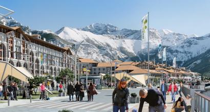
Many travelers have already visited the architectural sights of Kazakhstan, which Astana, Almaty and other cities of the country are rich in, but its natural landscapes are not inferior to them. Steppes, deserts, meadows, mountain ranges and lakes form unique picturesque pictures and natural complexes. In Kazakhstan, Lake Balkhash is the second largest non-drying body of water after the Caspian Sea. It is located in the east of the republic. Lake Balkhash is the main natural attraction of the country and a great asset of the Kazakh people. Nowadays, many tourists try to see Lake Balkhash when they visit Kazakhstan.
Balkhash is a semi-fresh water drainless, the second largest after the Caspian Sea, a saline non-drying lake. In the list of the largest lakes in the world, it occupies the fourteenth place. Interestingly, Balkhash is located on the territory of three regions of Kazakhstan - Almaty, Karaganda and Zhambyl. Lake Balkhash looks like a long crescent. Its waters have an amazing fact. The lake is divided into two parts by a narrow strait, the water in which is different in chemical composition. In the west of the lake, the water is almost fresh, and in the east it is salty. This is the unique composition of water.
The lake is located in the Balkhash-Alakol basin at an altitude of 340 m above sea level. The length of the reservoir is 605 km, the width in the east is from 9-19 km, in the west - 74 km. The area of the lake is 16.4 thousand square meters. km. The greatest depth is 26 m.
The word "Balkhash" originated from the word "balkas", which from the Kazakh, Tatar and Altai languages means "hummocks in the swamp", "marshy area covered with hummocks".
Legend
According to the legend about the origin of the lake, the wealthy sorcerer Balkhash had a beautiful daughter, Ili. When the time came to marry her, Balkhash announced that he would give Ili only for the strongest, most beautiful and richest. Among the suitors who arrived were two sons of the Chinese emperor with caravans littered with expensive goods; sons of the Mongol Khan with horses and silver; and young Bukhara merchants with products from Ivory and carpets. But among the applicants was the poor shepherd Karatal, with whom the girl immediately fell in love.
After the competition, in which Karatal won, Balkhash kicked him out. But at night, Ili ran away from home and rode off with the chosen one from her father. Balkhash, having learned about the escape of his daughter, cast a spell on the young, and they turned into two rivers that swiftly carry their waters from the mountains. And so that these rivers never connected, Balkhash fell between them and became a lake.

History
The first information about Lake Balkhash was found in Chinese written sources. This is due to the fact that the Chinese were the only advanced civilization that lives nearby and has the opportunity to get to know this area. The region to the west of the Great Chinese wall, they called "Si-Yu", which means "Western Territory". They knew about its existence already in 126 BC. By 607, the Chinese had already compiled maps of 44 countries that were at that time in the territory of Central Asia. But these descriptions have not survived to this day.
According to some reports, Lake Balkhash was known to the Chinese under the name "Si-Hai", i.e. "Western Sea". Under this name, it is noted on the atlas of 1855. In the same period, the lake had another name given to it by the Kalmyks and Dzhungars "Balkhash-Nor" ("Lake Balkhash"). And the eastern peoples, such as the Turks and Mongols, who denoted everything with white geographic features west of their dwellings, they called it "Ak-Dengiz" ("White Sea"). And after the borders of their countries moved to the west, the lake became "blue" (eastern) - "Kukcha-Dengiz". The Kazakhs called the lake "Tengiz", which means "Sea".

In the 18th century, the lake was marked on several maps: on the map of 1716, which were published by the Swedish officer Renat, and on Russian map compiled by Captain Stralenberg in 1730.
During the reign of the Chinese Qing Dynasty (1644-1911), the lake extended along the northern border of the Chinese state. In 1864, in accordance with the Russian-Chinese agreement regarding the northwestern border, Balkhash and the territories adjacent to it were ceded to Russian Empire.
In 1903-1904, the lake and the territories adjacent to it were studied by the expedition of L.S. Berg. As a result, it was established that Balkhash is located outside the boundaries of the Aral-Caspian basin, and that they never united in their geological past. It is interesting that Berg, studying the reservoir, came to the conclusion that the lake does not decrease and the water in it is fresh. He also noted that there was a period when Balkhash completely dried up, but then it was filled with water again, and since that time its water had not yet had time to become salty.
Currently, Balkhash is attracting everyone's attention with a find that was revealed by helicopter pilots. Making a flight over the isthmus, which divides the lake into salty and freshwater areas, they discovered the outline of protective ramparts with watchtowers. There was another confirmation that a thousand years ago there were two autonomous lakes on the site of the current lake. Today, the lake can be waded along this isthmus. The city found at the bottom was the center of the Great Silk Road to Sary-Arka.

Climate around Balkhash is considered deserted. average temperature July here is +30 C, January - about -14 C. Dry climate, winds and temperatures lead to a high rate of water evaporation - in cool years, the norm is from 950 mm, and in dry years it reaches up to 1200 mm. Balkhash is a warm, well-heated lake. The water temperature on its surface ranges from 0 C in December to +28 C in July. The average annual temperature of the western part of the lake is +10 C, the eastern - +9 C. Every year the lake freezes, and there is usually ice here from November to early April, besides, the glaciation in the east is delayed by 10-15 days.
Flora and fauna
The lake belongs to the habitat of great cormorants, pheasants, teals, egrets and golden eagles. Of the 120 species of birds, 12 are listed in the Red Book, including pink and curly pelicans, whooper swan, spoonbill and white-tailed eagle.
Balkhash has a rich fauna, but starting from the 1970s, the water quality began to deteriorate, which caused a decrease in the species diversity of the fauna in the lake. Before that, about 20 species of fish lived in it. Now fishing in the Balkhash region is possible for such types of fish as carp, catfish, pike perch, asp, vobla, perch, crucian carp, bream and others.
On the shores of the lake you can find such plants as turanga, willow, from cereals - southern cattail, common reed and several types of reeds. In the reed beds you can see wild boars.

Tourism
Vacationers on the territory of the lake are offered different types of pastime. So in rest houses there are all conditions for have a great holiday, clear water suitable for swimming, and on the beach you can sunbathe. The area is also uniquely suited for fishing and hunting. Arriving at Lake Balkhash, travelers discover its charming nature, unusual animal and vegetable world and other beauties. Since this area is considered an excellent recreational center, it will provide positive energy.
Recreation centers on the lake provide an opportunity to use natural healing factors for healing a person. Lake salt and mud, which are found in springs near the reservoir, have special properties. Bathing in clean water and bright sun promotes recreation. A recreation industry is developing around the lake at coastal bases.
The surroundings of the lake are divided into several dozen zones, each of which has camp sites, holiday homes and hotels. The tourist cluster has catamarans, scooters, boats, boats, water skis, tennis tables, sports and playgrounds. The shores and buildings have been landscaped, they have dance halls, bars, restaurants, and health services are provided. Almost in any sanatorium or hotel they accept guests with children, for whom children's rooms and animators work.

With a fishing rod on the shore of the lake, a high-quality holiday will be spent, because the atmosphere here is calm and peaceful. Balkhash is a large deposit, where even novice anglers will not be left without fish. For the sake of fishing people come here in spring, summer and early autumn. In April, the pre-spawning process of the famous Balkhash vobla takes place. Usually the water warms up a little after the winter, you can already catch carp and carp. So, fishing on Lake Balkhash will give real pleasure to lovers of this activity, and to those who just want to relax in the bosom of nature.
There are also great opportunities for hunting enthusiasts. Here you can trade for ducks, wolves, foxes, hares, geese, pheasants, and hunting for mallards and coots will bring special pleasure. Spearfishing will also be an interesting activity. In order to take part in this event, there is no need for professional equipment, you just need to take a speargun, masks and snorkels with you. For many divers, this place is a traditional holiday destination.

The list of services and specialization of tourist centers, hotels, health resorts may differ. There are places where only fishermen are welcome, and there are places where only a beach holiday is possible. Therefore, before traveling, it is advisable to familiarize yourself with complete list basic and additional services, and choose the place of rest that meets all the requirements.
Lake Balkhash is an amazing body of water in Kazakhstan. Its visit will bring a lot of impressions and energize every vacationer. A variety of recreation options allow you to organize your pastime according to your preferences.
Lake Balkhash is one of the unique lakes on the world map. It has neither surface water runoff nor underground drainage. In fact, such reservoirs are salty. But this lake is salty and fresh at the same time. It is unique in that its water area is divided into two zones: western and eastern. Rivers flow into it throughout its length, replenishing it with water.
In the first, shallow, water is fresh, in the second, deeper, it is salty. This reservoir occupies the 2nd place after the Caspian in terms of the size of non-drying salt lakes and stands in 14th place as a large salt and fresh lake in the world. it interesting place on the map of Kazakhstan attracts tourists from many countries, including Russia. Travelers go to local hotels and sanatoriums to find a rest from the city stuffiness here.
old legend

There is a legend about the origin of the lake. Once upon a time, a domineering and powerful khan named Balkhash picked up and adopted a little girl, naming her Ili.
Over the years, she has grown into a beauty. When the time came to marry her off, a tournament was held and a poor man named Karatal won. Balkhash did not want to give his daughter as a wife to the poor, and the young people decided to run away. Rushing into pursuit, Balkhash used evil magic to separate the lovers, turning them into two halves of a lake.
If you look at the map, Lake Balkhash is located in the southeastern part of Kazakhstan in the Balkhash-Alakol water management basin. The basin of the reservoir has the shape of a crescent, where the rivers flow, and is divided into two zones connected by an isthmus, the depth of which is not great. The length of the coastline, very winding, indented with bays and bays, reaches 2500 km. The average depth in Lake Balkhash is 5.8m.

In the north and west the coast is rocky, in the south the coast is sandy. The rivers flowing into the Balkhash provide replenishment of the water balance. Visible on the map major river Or, also flowing into the lake, the main source running from the Tien Shan glaciers to where Lake Balkhash is located.
The weather here is determined by the peculiarities of the climate. The territory adjacent to the lake has a desert climate, the summer temperature is about +30°C, the water warms up to +28°C, in winter it can reach -15°C. Wind, rather dry climate and high temperature cause rapid evaporation of water.
Lake Balkhash has a rich and diverse flora and fauna, which attracts travelers.
Endorheic lake Balkhash - water world
Types of recreation
Recreational opportunities on Lake Balkhash are varied. This is due to the very comfortable weather on Lake Balkhash, as well as the fact that it is quite warm and well warmed up.
Here you can choose different types of holidays. This is an active and passive pastime in a sanatorium, hotel, recreation center on Lake Balkhash. Only having been here once, you can see how beautiful this lake is, how comfortable the weather is here.
Many along the coast sandy beaches. The air temperature and the depth of the reservoir allow organizing the swimming season from May to September. Comfortable water temperature, optimal depth, wonderful weather throughout beach season attracts hundreds of tourists here.
The recreation areas of Lake Balkhash are located along almost the entire coastline. It offers vacationers walks on a boat or yacht, riding a scooter, swimming and surfing, diving and spearfishing. You can take a horse or camel ride.

Recreation centers and hotels invite the most daring travelers on helicopter tours, where Lake Balkhash will appear from a height, and tourists will see how beautiful it is. For 3.5 hours of flight you will have to pay about 35 thousand rubles.
Unforgettable can be winter holidays. The weather is mild in winter, the air temperature at this time rarely drops below 15 ° C, which allows you to go to different leisure areas: skiing along the shore of a frozen reservoir, riding snowmobiles, and windsurfing on ice is also popular.
Such entertainment gives the traveler this unusual insipid and at the same time salt Lake.
Paradise for anglers

Fishing is good on Lake Balkhash, as there is a rich fauna that provides fishermen with exciting hours of leisure. For fishing, there are special places with accommodation, you can also rent necessary equipment. Having retired with a fishing rod, even a beginner will be rewarded with a good catch.
Fishermen come here for the most famous fish of Lake Balkhash - roach. She is lured in all sorts of ways: on a worm, corn, maggot. They catch with a fishing rod and a donkey.
Also during the season (spring and July-September), Lake Balkhash is rich in crucians, carps, catfish, asps. And there are also snakeheads here. This is a very scary-looking fish, but very tasty. Fans of fishing in Balkhash should also know about marinka fish, or kara-balyk. She is poisonous, or rather her caviar, milk, and black films on her abdomen. And marinka meat is very fatty and tasty. Recreation areas also offer underwater fishing.
Fishing on Lake Balkhash
A calm, peaceful atmosphere on the banks of the Balkhash or the river flowing into it and a rich catch are annually invited here by hundreds of fishermen from Russia. Both an avid angler and an amateur will get a good rest here.
Where to stay on Lake Balkhash
Travelers will find a large selection of places to stay while relaxing on the lake. These are recreation centers, and sanatoriums, and the private sector.
The most affordable option is tourist bases and holiday homes in villages located on the coastline. It:
- Torangylyk,
- Chubar-Tubek,
- Rembaza,
- Shubartubek and many others.
Living conditions here are modest. The room is located in a wooden house without amenities. Shower, toilet, washbasin are shared. The price in such a house is 150 rubles per day for one person.

A higher level of accommodation awaits the tourist in the hotel. For example, the Doszhan hotel offers everything you need for comfort, there is also satellite TV, a beach, sports grounds, and a gym. A double room in such a hotel will cost 500-1000 rubles.

The most comfortable accommodation can be found in the Riva Lepsy recreation area. There are all amenities, three meals a day, mud procedures, peeling, massage. Guests can entertain themselves with water skiing, billiards, dancing. There is a playground with inflatable pools. The price ranges from 600 rubles to 2000 for two, depending on the season.

If you are interested in life local residents, you can stay on vacation in private housing in small towns and villages located on the coast and not far from it. Tourists are always welcome here. You can rent a small room in the owner's house, a whole house or a yurt. It will cost from 200 rubles per person per day.
Treatment at Balkhash
Lake Balkhash is ready to provide not only rest, but also treatment, which contributes to good weather throughout almost the entire year. Sanatoriums have been built here. The treatment is based on the strengthening properties of salt water, as well as mud rich in minerals and hydrogen sulfide. To this is added the clean air of the steppe, enriched with mineral salts. Such treatment can be obtained in sanatoriums on Lake Balkhash.

One of the most famous sanatoriums is Balkhash. Located in the city of Priozersk, offers mud therapy and balneotherapy. Treatment in this sanatorium, located a hundred meters from the lake, can be successfully combined with a beach holiday. The sanatorium is equipped with three buildings: sleeping, sports, medical.
There are many health-improving procedures in the sanatorium, ranging from hydrotherapy and inhalations to massage and various special examinations. There are procedures included in the price of the tour, as well as children's treatment. The cost of a ticket, depending on the category, ranges from 29,000 to 49,000 rubles.
The Balkhash dispensary is also widely known among tourists. There are many visitors to this sanatorium every year, as the rest here is also comfortable. The cost of the ticket is from 27,000 rubles.
Video: Disaster on Lake Balkhash
Balkhash (Balkhash; Kaz. Balash) is a drainless semi-freshwater lake in the Balkhash-Alakol basin in the southeast of Kazakhstan, the second largest non-drying salt lake (after the Caspian Sea) and 13th in the list of the largest lakes in the world. The uniqueness of the lake lies in the fact that it is divided by a narrow strait into two parts with different chemical characteristics of water - in the western part it is almost fresh, and in the eastern part it is brackish.
The lake belongs to the Balkhash-Alakol water management basin and is located in three regions of Kazakhstan at once: Almaty, Zhambyl and Karaganda. To the north of the lake there is a vast Kazakh hillock, to the west Betpak-Dala stretches, and in the south there are the Chu-Ili mountains, the sands of Taukum and Saryesik-Atyrau.
Title and legend
The toponym "Balkhash", according to one version, comes from the word balkas of the Tatar, Kazakh and Altai languages, which means "marshy area covered with hummocks" or "hummocks in a swamp". In the Kazakh language, "beam" means "melting metal", "melting". The etymology from “balku” is confirmed by the archaeological data of the expedition of Academician A. Margulan (see the “History” section below) in the Balkhash region as the center of ancient metallurgy of the Eneolithic and Early Bronze Ages, as well as the boreal (Nostratic) nature of the verb protoform *Blk (Proto-Indo-European *Brk) , meaning "sparkle", "burn", "burn", "melt", "melt".
According to the legend about the origin of the lake, the rich sorcerer Balkhash had a beautiful daughter, Ili. When the time came to give Or in marriage, Balkhash announced that he would marry her only to the richest, most beautiful and strongest. Among the grooms who arrived were two sons of the Chinese emperor with caravans loaded with expensive goods, the sons of the Mongol Khan with herds of horses and silver, as well as young Bukhara merchants with carpets and ivory products. However, among those who wished to try their luck was the poor shepherd Karatal, who immediately liked the bride.
After the competition, from which Karatal emerged victorious, Balkhash indignantly kicked him out. However, Ili ran away from her home at night and rode away with her chosen one from her evil father. Having learned about the escape of his daughter, Balkhash cast a spell on his beloved, and they turned into two rivers, swiftly carrying their waters from the mountains. And so that the rivers would never connect, Balkhash fell between them and became a lake gray from the foamy waves.
History
The first historical and geographical information about Lake Balkhash appeared among the Chinese, who, having contacts with Central Asia, could get to know this region earlier than others. The area to the west of the Great Wall of China was called "Si-Yu" (Western Territory) by the Chinese and knew of its existence as early as 126 BC. e. In 607, maps of 44 states that existed at that time in Central Asia were compiled, but these descriptions have not been preserved. Since the 8th century, the territory from the lake to the Tien Shan mountains has been known as Semirechye (Kazakh Zhetisu, Kirg. Zhetisuu), where the cultures of nomadic (Turks and Mongols) and sedentary peoples of Central Asia mixed.
Alexander von Humboldt believed that Lake Balkhash was known to the Chinese under the name "Si-Hai" (Western Sea; this name was transferred to the atlas of 1855). The name "Balkhash-Nor" (Balas-nur - "Lake Balkhash"), given to the lake Dzungars and Kalmyks, reflected on the map of Julius Klaproth in 1833, compiled from the footage of European ambassadors. The Turks and Mongols, who designated in white all geographical objects to the west of their settlements, called it “Ak-Dengiz” (“white sea”), and when the borders of their states moved to the west, the lake became “blue” (eastern) - “ Kukcha-Dengiz. The Kazakhs called the lake "Tengiz" (kaz. Teiz), which means "sea".
XVII-XIX centuries
In the second edition of the book Big Drawing (1627) there is no lake, although there is information about other inland water bodies, such as the Aral Sea. In the map called "Drawing of the land of the entire waterless and impenetrable stone steppe", compiled in 1695 by the Tobolsk cartographer Semyon Remezov, Lake Balkhash is present under the name "Tengiz Sea". It is worth noting that the lake was noted very inaccurately - the Syr Darya and Amu Darya flow from it from the west, and 8 rivers flow from the east. In the center of Balkhash, a large mountainous island of Koishor is marked. Despite these inconsistencies, it should be noted that the authors did a great job, drawing up a drawing from the words of old-timers and ambassadors.
In the XVIII century, "Tengiz" appears on several maps: in the map of the Swedish officer I. G. Renat published in 1716 (the outlines of the lake were closest to reality), as well as on the "map of Russia in Great Tataria", which was compiled by Captain Philip Stralenberg and published in 1730 in Stockholm.
After the fall of the Dzungar Khanate in 1756, surveyors began to be sent with caravans to Western China, and by the beginning of the 19th century there were already several questioning maps of Dzungaria, but there was no reliable information about the Balkhash region and the lake itself. In 1834, the astronomer V.F. Fedorov determined the exact position of Lake Balkhash and partially photographed its coast, and in the period from 1837 to 1843 several expeditions were made to the lake area, its shores were studied, and a trial fish was made, which showed the absence of red fish and the insignificance of the catch, in comparison with the fishery on Lake Zaisan. The expedition of 1851-1852 studied the depths of the lake and the possibility of navigation on it. During the Chinese Qing Dynasty (1644-1911), the lake was the northern border of the Chinese state, but in 1864, in accordance with the Russian-Chinese agreement on the northwestern border, Balkhash and the territories adjacent to it were ceded to the Russian Empire. In 1850-1860, the Balkhash depression and the Ili River basin were explored by the Kazakh scientist Ch. Ch. Valikhanov, who pointed out the similarity in the origin and historical formation of the Balkhash and Alakol depressions.
20th century
Lake Balkhash and adjacent territories on a 1903 map, from Samuel Orgelbrand's encyclopedia
A great contribution to the study of Lake Balkhash was made by the Russian geographer Lev Semyonovich Berg. In 1900-1906, the Turkestan department of the Russian Geographical Society instructed him to carry out a geographic and hydrological study of the Aral Sea. During this expedition in 1903-1904, among other things, he made an instrumental survey of the shores of Balkhash, the lower reaches of the Ili and the areas adjacent to the lake. In addition, Berg explored the lake itself and its possible connections with by the Aral Sea and proved that Balkhash lies outside the Aral-Caspian basin, and that they did not connect in the geological past. It is interesting to note that when Lev Semyonovich Berg studied Lake Balkhash, he came to the conclusion that it does not dry out, and the water in it is fresh. The researcher argued that “Balkhash was once completely dry, and later filled with water again, since then it has not yet had time to become salty.” From these results and from the poverty of the fauna of the lake, a conclusion was drawn about the youth of the reservoir.
A detailed physical and geographical description of the basin of Lake Balkhash was carried out in 1910 by B. F. Meffert. He studied the river systems of Mointy, Jamchi and Tokrau, located in the northern Balkhash region, and attributed the soil cover to the loess type. Meffert believed that the Northern Balkhash region in its own way geological structure refers to the ancient Paleozoic. In addition, he suggested that when the water level in Balkhash was 30 meters higher than the current one, the lake connected with the Sasykkol, Alakol and Ebi-Nur lakes located to the east.
AT Soviet time studies of the lakes of Central Asia were carried out by the State Hydrological Institute. Particular attention was paid to the physicochemical research direction of mineral lakes for the needs of the salt and chemical industries, as well as balneology.
Origin of the lake
 Lake Balkhash basin
  Satellite image of the mouth of the Karatal
Balkhash lies in the deepest part of the vast Balkhash-Alakol basin, which was formed as a result of a gentle deflection of the Turan Plate in the Neogene-Quaternary and subsequently filled with sandy river deposits. The hollow is part of the fault system of the Dzhungar Alatau, in which the Sasykkol and Alakol lakes and the Ebi-Nur lake (behind the Dzhungar Gates) are also located. These lakes are the remains of the ancient Khankhai Sea, which once occupied the entire Balkhash-Alakol depression, but did not connect with the Aral-Caspian basin.
Relief
The area of Lake Balkhash is approximately 16.4 thousand km (2000), which makes it the largest of the lakes entirely located on the territory of Kazakhstan. Balkhash lies at an altitude of about 340 m above sea level, has the shape of a crescent. Its length is approximately 600 km, the width varies from 9-19 km in the eastern part to 74 km in the western part. The length of the coastline is 2385 km. The Saryesik peninsula, located approximately in the middle of the lake, hydrographically divides it into two very different parts. The western part (58% of the total area of the lake and 46% of its volume) is relatively shallow and almost fresh, while the eastern part has great depth and salt water. Through the Uzynaral strait formed by the peninsula (kaz. ?zynaral - “long island”), 3.5 km wide, water from the western part replenishes the eastern one. The depth of the strait is about 6 m.
View of Lake Balkhash from space NASA image, August 2002.

The basin of the lake consists of several small depressions. In the western part of Balkhash there are two depressions up to 7-11 m deep - one of them stretches from west coast from Tasaral Island to Cape Korzhyntubek, the second stretches to the south from Bertys Bay, which is the most deep place western Balkhash. The depth of the basin of the eastern Balkhash reaches 16 m, the greatest depth of the entire eastern part is 27 m. The average depth of the entire lake is 5.8 m, the total volume of water is about 112 km.
The western and northern shores of Balkhash are high (20-30 m) and rocky, composed of Paleozoic rocks (porphyry, tuff, granite, shale, limestone) and have traces of ancient terraces. The southern shores from the Karashagan Bay to the delta of the Ili River are low (1-2 m) and sandy, periodically flooded into high water (because of which they are dotted with numerous small lakes), in places there are coastal hills 5-10 m high. Coastline very winding and dissected by numerous bays and bays. Large bays of the western part: Saryshagan, Kashkanteniz, Karakamys, Shempek (the southern end of the lake), Balakashkan and Akhmetsu. In the eastern part, the guzkol, Balyktykol, Kukun and Karashigan bays are distinguished, the Baigabyl, Balai, Shaukar and Kentubek and Korzhintobe peninsulas are also located there.
There are few large islands on the lake, Basaral and Tasaral (the largest), as well as Ortaaral, Ayakaral and Olzhabekaral are located in the western part of the lake. In the eastern part there are the islands of Ozynaral, Ultarakty and Korzhyn, as well as the island of Algazy. In total, there were 43 islands on the lake. with total area 66 km, however, with a decrease in the water level, new islands are formed, and the area of existing ones increases.
Lake nutrition and water level
The Balkhash-Alakol basin has an area of 512 thousand km, and its total surface runoff in an average year is 27.76 km, including 11.5 km from the territory of the PRC. The area of the drainage basin of Lake Balkhash alone is about 413 thousand km2, with 15% of its territory lying in the northwest of the Xinjiang Uygur Autonomous Region of China, and a small part in Kyrgyzstan. Of the total runoff of the Balkhash-Alakol basin, 86% falls on Lake Balkhash, the flow of the Ili River is up to 12.3 km/year (according to TSB data, about 23 km/year). Or falling into western part lakes, gives 73-80% of the total inflow of water into the lake. The river begins in the Tien Shan mountains and is fed mainly by glaciers, which causes daily and seasonal fluctuations in the water level - the period of melting of mountain glaciers falls on June - July. At the confluence with Lake Ili, it forms a delta with an area of 8,000 km with many channels (Kur-Li, Ak-Uzek, Jide and others). The Ili delta plays the role of a natural regulator, giving part of the accumulated water to the lake in dry years. Upstream of the river, not far from the village of Bakanas, from Ili, on the right, the dry channel Bakanas departs - one of the ancient branches of Ili, which flowed into the lake east of the Saryesik peninsula.
The rivers Karatal, Aksu, Lepsy flow into the eastern part of the lake, in addition, the lake is fed by groundwater. Originating on the slopes of the Dzungarian Alatau, the Karatal River is the second most important tributary of Lake Balkhash. The waters of the Ayaguz River, which fed the eastern part of the lake until the 1950s, now practically do not reach it. The annual difference in the tributaries of the western and eastern parts of the lake is 1.15 km.
Water balance of the lake, 2000
The volume of runoff into the lake basin in 2000 was 22.51 km, of which:
- surface water inflow - 18.51 km, underground - 0.9 km, through precipitation and ice - 3.1 km.
Expenses for the year amounted to 24.58 km:
- for evaporation - 16.13 km, in the delta of the Ili River - 4.22 km, ice formation - 0.749 km, housing and communal services - 243.97 million m?, industry - 219.14 million m?, agriculture - 3238.67 million m?, fisheries - 26.9 million m?.
The area and volume of the lake varies greatly in accordance with long-term fluctuations and short-term fluctuations in the water level. Long-term fluctuations have an amplitude of 12-14 m, the minimum values fell on the period from the 5th to the 10th century, and the maximum water level was observed from the 13th to the 17th century. At the beginning of the 20th century and in the period from 1958 to 1969, the area of the lake increased to 18-19 thousand km, and during droughts, for example, at the end of the 19th century or in the 1930s and 1940s, the lake shrank to 15.5- 16.3 thousand km. The amplitude of fluctuations in the water level in the lake was about 3 m. In 1946, the surface area of the lake was 15,730 km2, and the volume was 82.7 km2. At the beginning of the 2000s, the lake is in the process of decreasing due to the diversion of the rivers flowing into it for economic purposes. So, on the Ili River in 1970, the dam of the Kapchagai hydroelectric power station was built, which formed the Kapchagai reservoir. When this reservoir was filled, the water balance of Balkhash was disturbed, which caused a deterioration in water quality, especially in the eastern part of the lake. From 1970 to 1987, the water level decreased by 2.2 m, and the volume - by 30 km. The conducted studies showed that if the natural diet had been preserved, then from 1975 to 1986 the phase of lake reduction would have begun, that is, anthropogenic and natural factors affected the lake ecosystem in one direction. Options for solving the problem of increasing salinity in the western part were proposed, based on the division of the lake by a dam, but the implementation of such plans was impossible due to the economic situation in the country.
The minimum water level in the lake (340.65 meters above sea level) was recorded in 1987 after the filling of the Kapchagai reservoir, and in January 2005 there was an increase in the level to 342.5 meters, which some experts associated with a large amount of precipitation that fell over last years.
Water composition
Lake Balkhash is classified as a semi-freshwater lake - chemical composition water depends on the hydrographic features of the reservoir. The water of the western part of the lake is almost fresh (mineralization is 0.74 g / l) and more turbid (transparency - 1 m), it is used for drinking and industrial supply. East End has a high salinity (from 3.5 to 6 g/l) and transparency (5.5 m). The total average mineralization in Balkhash is 2.94 g/l. The long-term (1931-1970) average salt sediment in Balkhash is 7.53 million tons, the reserves of dissolved salt in the lake are about 312 million tons. The water in the western part has a yellowish-gray tint, and in the eastern part it changes from bluish to emerald blue which can be seen on satellite images.
Climate
15 -4.8 -13.1Temperature in °C Precipitation total in mmSource: Weather and Climate - Balkhash climate
 Lake Balkhash in spring, 2008
The climate in the lake area is desert. The average temperature in July is about 30 °C, in January - about ?14 °C. Precipitation averages 131 mm per year. The average annual relative humidity is about 60%. Winds, dry climate and temperature lead to a high rate of water evaporation - in cool years, the annual evaporation rate is 950 mm, and in dry years it reaches 1200 mm.
The average annual wind speed is about 4.5 - 4.8 m / s, and in the western part of the lake north winds prevail, and in the eastern part - northeast. The wind causes strong excitement on the lake (wave height can reach 2-3.5 m), in the western part there is a constant circular current directed clockwise.
Number sunny days is 110-130 per year, energy illumination - 15.9 MJ per mv day. Balkhash is one of the warm, well-heated lakes. The water temperature on the surface of the lake varies from 0 °C in December to 28 °C in July. The average annual temperature in the western part of the lake is 10 °C, in the eastern part - 9 °C. The lake freezes annually, and the ice usually lasts from November to early April, and the glaciation from the eastern part occurs with a delay of 10-15 days.
Lake water temperature (°C) depending on depth (data from 1985-1987)
Eastern part of the lake
-Animal and plant world
 coastal reed
Turanga grows on the shores of the lake (as part of tugai forests) and willow, from cereals - common reed (Phragmites australis), southern cattail (Typha angustata) and several types of reeds - seaside (Schoenoplectus littoralis), lake (S. lacustris) and endemic species Kazakhstan bulrush (Scirpus kasachstanicus). Two types of urutia grow under water - spiked (Myriophyllum spicatum) and whorled (M. verticillatum), several types of pondweed: brilliant (Potamogeton lucens), pierced (P. perfoliatus), curly (P. crispus), comb (P. pectinatus) and large-fruited (P. macrocarpus); there are common pemphigus (Utricularia vulgaris), dark green hornwort (Ceratophyllum demersum), as well as two species of naiads (marine and small). Phytoplankton, whose concentration in 1985 was 1.127 g/l, is represented by numerous species of algae.
The fauna of the lake was quite rich, but starting from the 1970s, biodiversity began to decline due to deteriorating water quality. Until that time, benthos was represented by molluscs, larvae of crustaceans, and aquatic insects. Bell mosquitoes and oligochaete worms are also represented. Zooplankton (concentration 1.87 g/l, 1985) was also quite abundant, especially in the western part. There were about 20 species of fish in the lake, of which 6 were native - Ili (Schizothorax pseudoksaiensis) and Balkhash (S. argentatus) marinka, Balkhash perch (Perca schrenkii), spotted (Nemachilus strauchi) and one-color sloth (N. labiatus) and Balkhash minnow (Phoxinus poljakowi), and the rest - introduced: carp, spike, oriental bream (Abramis brama orientalis), Aral barbel (Barbus brachycephalus), Siberian dace, carp, tench, pike perch, catfish, osman, silver carp and others. The main commercial fish were carp, pike perch, asp and bream.
Reeds, which grew abundantly on south coast lakes, especially in the Ili delta region, served as an excellent refuge for birds and animals. A change in the hydrological regime downstream of the Kapchagai reservoir led to the degradation of the Ili delta - since 1970 its area has decreased from 3046 km to 1876 km, resulting in the reduction of wetlands and tugai forests - habitats for birds and animals. Land development, pesticide use, overgrazing and reed cutting have also affected the biodiversity of the basin. Of the 342 species of vertebrates, 22 are listed in the Red Book of Kazakhstan. Until the middle of the 20th century, the Turanian tiger lived in the forests of the delta, which fed on wild boars that lived there. In the lower reaches of the Ili, in the 1940s, thanks to the efforts of A. A. Sludsky, the muskrat brought from Canada was acclimatized. The starch-rich rhizomes of cattail have become good food for it, but in recent years, due to constant winter floods that occur as a result of discharges from Kapchagay and cutting down reeds, the habitats of the muskrat have been destroyed and its fishery, which previously reached 1 million animals per year, has been completely stopped. .
Balkhash belongs to the habitat of great cormorants, teals, pheasants, golden eagles and egrets. Of the 120 species of birds, 12 were included in the Red Book, including pink and curly pelicans, spoonbill, whooper swan and white-tailed eagle.
Cities and economy
 View from the lake to the Balkhash Mining and Metallurgical Combine
In 2005, 3.3 million people lived in the Balkhash basin, including residents of Alma-Ata - largest city Kazakhstan. The largest settlement on the shore of the lake is the city of Balkhash with 74 thousand inhabitants (2007). The city is located on the northern shore of the lake, its city-forming enterprise is the Balkhash Mining and Metallurgical Combine. A large copper deposit, discovered in 1928-1930, is being developed in settlements north of the lake, such as Konyrat and Sayak. Along the western shore of the lake there is a section of the M36 highway from Bishkek to Karaganda, on which settlements Gulshat, Balkhash-9, Saryshagan and Priozersk. The settlements of Ulken, Mynaral and Shyganak are located in the southern part of the western coast.
On the western shore of the lake, near the city of Priozersk, there are quite a few military facilities built in the Soviet era. In the military town of Balkhash-9, the radar stations of the Daryal-U, Dnepr and Dnestr missile warning systems are located. To the west of the village of Saryshagan, there is a missile defense test site, and a little to the south, near the Kashkanteniz Bay, there was a test site for laser weapons Terra-3.
The southern shore of the lake is practically uninhabited. The village of Kuygan is located at the mouth of the Ili, and the village of Kopbirlik is located at the mouth of the Karatal. Near the eastern end of the lake there is a section of the Turkestan-Siberian highway between Ayaguz and Taldykorgan. At intersection railway and the Lepsy River there is a village of the same name.
The recreational potential of the lake and the surrounding sights (the Bektau-Ata tract, tugai forests) attract numerous tourists, there are several boarding houses. As part of the lake conservation movement, various sporting events are held.
Fishing
Despite the comparative poverty of the fauna, the economic importance of Lake Balkhash is based on fishing and fish farming, which began in the 1930s. In 1952, the annual catch was 20 thousand tons, in the 1960s up to 30 thousand tons of fish were caught per year, including up to 70% of valuable species. However, already in the 1990s, production fell to 6.6 thousand tons per year, of which only 49 tons of valuable rocks. The decline in fishing rates is due to the current lack of programs for the reproduction of fish resources and their species composition, as well as the widespread poaching.
Energy projects
 Lake Balkhash, suburbs of the city of Priozersk
In 1970, the Kapchagai hydroelectric power station with a capacity of 364 MW was built on the Ili River, which made it possible to use the hydropower potential of the river, as well as to take water from the formed Kapchagai reservoir for irrigation. Water resources of Ili are intensively used even in the upper reaches (on the territory of the XUAR) for the cultivation of cotton, for which 40% of the region's arable land is allocated. There is currently a project to build an additional counter-regulatory dam at Ili, 23 km downstream from Kapchagai. The 49.5 MW Kerbulak HPP will help to partially solve the problem of providing electricity to the southern zone of Kazakhstan and will serve as a buffer for daily and weekly fluctuations in the flow of the Ili River.
They tried to solve the problem of energy supply in the southeastern part of Kazakhstan back in the days of the USSR: a plan was developed to build a power plant on the shores of Lake Balkhash. In 1979, a site was chosen for the construction of the South Kazakhstan State District Power Plant, and the settlement of Ulken was founded, but after a while the work was mothballed. In 1997, at the suggestion of V.S. Shkolnik, it was decided to use the site for the construction of a nuclear power plant, but the protests of environmentalists and residents of the country again forced the plans to be revised, and at the end of 2008 the government decided to build the Balkhash TPP.
Shipping
 Water station Balkhash, view from the parachute tower.
Regular navigation is carried out along Lake Balkhash, the lower course of the Ili River and the Kapchagay reservoir (the Borokhudzir pier in the city of Kapchagay). Main piers: Burylbaital, Burlitobe. The fleet is used mainly for catching and transporting fish, as well as transporting mineral construction cargo and livestock products and Agriculture. The total length of waterways is 978 km, the duration of navigation is 210 days. On Lake Balkhash, as well as in other basins, due to lack of funding, dredging and dredging are currently reduced to a minimum, which does not allow the use of large-tonnage fleet in most areas.
Navigation on Lake Balkhash was organized in 1931 - two steamships and three barges were brought to the city of Balkhash. In 1996, up to 120 thousand tons of mineral construction cargo, 45 thousand tons of fish products, 20 thousand tons of gourds and 3.5 thousand people of passengers were transported across the lake, but by 2004 the volumes were reduced to 1 thousand people of passengers and 43 thousand tons of fish products. In 2004, a total of 87 vessels were operating in the Ili-Balkhash basin, including 7 passenger, 14 cargo barges and 15 tugboats.
It is assumed that by 2012 the volume of transported building materials in the Ili-Balkhash basin will reach 233 thousand tons, livestock and agricultural products - at least 550 thousand tons, and fish products - at least 53 thousand tons. It is also expected that the development of eco-tourism will cause an increase passenger traffic on Lake Balkhash, the volume of which will be up to 6 thousand people per year. Ore transportation volume water transport by 2012, at least 3,500 thousand tons per year is expected.
Ecological state
 Beach on Lake Balkhash
There are serious concerns for the ecology of Lake Balkhash, especially regarding the possibility of a repeat of a catastrophe similar to the Aral Sea. There are several reasons for this concern. Starting from 1970, the use of Ili water to fill the reservoir in Kapchagay, which took 39 km, led to a decrease in the flow of the river by 2/3 and a decrease in the level of the lake. The rate of water level decline was approximately 15.6 cm/year, which greatly exceeded the rate of natural decline in 1908-1946 (9.2 cm/year). The shallowing of the Balkhash is especially noticeable in its shallower western part. From 1972 to 2001, the small salt lake Alakol, located 8 km south of the lake, practically disappeared, and the southern part of Balkhash itself lost about 150 km of water during this period. Of the 16 lake systems around Balkhash, only five remained; the process of desertification has already covered about 1/3 of the basin. Salt dust is removed from the dried lake bed and floodplain areas, contributing to the formation of Asian dust storms and adversely affecting the climate of the region. In addition to salinization, the fertility of floodplain soils is affected by the reduction of biological flow into the delta due to the accumulation of silt in the Kapchagai reservoir.
Another factor affecting the ecology of the Ili-Balkhash basin is the emissions from the Balkhash mining and smelting plant. In the early 1990s, the volume of emissions was 280-320 thousand tons per year and 76 tons of copper, 68 tons of zinc, 66 tons of lead settled at the bottom of the lake. Since then, the amount of pollutants emitted has almost doubled. Harmful substances also enter the lake through leaks in the tailings during dust storms. As steps to improve the environmental situation, it was proposed to stop the filling of the Kapchagay reservoir, treat the wastewater of the metallurgical plant, reduce irreversible losses for irrigation, etc. At the International Environmental Forum on the problems of Lake Balkhash in 2005, it was stated that the Kazakhmys next year will complete the construction of environmentally friendly production, which will reduce emissions by 80-90%.
The main pollutants of Lake Balkhash are heavy metals (copper and zinc), as well as oil products, phenols and fluorides.
Surface water pollution level, WPI
- Kazakhstan
- 3954 views